2022:458 - GLANMANE, Camp, Kerry
County: Kerry
Site name: GLANMANE, Camp
Sites and Monuments Record No.: KE036-122
Licence number: 22E0040
Author: Tony Miller
Author/Organisation Address: Tooreen
Site type: Field boundary
Period/Dating: Modern (AD 1750-AD 2000)
ITM: E 465954m, N 608743m
Latitude, Longitude (decimal degrees): 52.214127, -9.961623
The landowner of a farm in Glanmane, Co. Kerry, had applied for an afforestation grant for parts of his land. A previous Impact Assessment, including a walkover survey, in 2021 by this author, had recorded a large number of unrecorded monuments. These included clocháns, hut sites, enclosures, relict field systems and a farm complex. These new discoveries led to two plots being withdrawn from afforestation. One area, Plot 1, was kept in the scheme with a licensed monitoring condition put on it.
Plot 1 was a large area of partially reclaimed rough grazing and shallow bog. It was level with the slopes of the Dingle mountains rising to the south and extensive views to the north over Tralee Bay.
All the newly recorded sites have now been listed on the SMR.
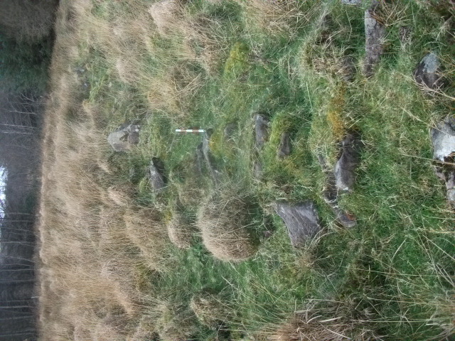
A single length of relict field boundary was discovered rising above the bog in the south-west corner of the Plot. It was built of randomly placed field stones and ran east-west for c. 60m. It was c.1m high and c. 0.6m wide and would appear to be associated with a field and farm complex to the west, containing extensive ‘lazy beds’, recorded in Plot 3. A 10m buffer zone was established on either side of this field boundary which has been left unplanted.

