2022:298 - KILLEEN, DROMTHACKER AND GARRANE, Kerry
County: Kerry
Site name: KILLEEN, DROMTHACKER AND GARRANE
Sites and Monuments Record No.: N/A
Licence number: 22E0520
Author: Tony Bartlett, Archaeological Management Solutions
Author/Organisation Address: Fahy’s Road, Kilrush, Co. Clare
Site type: Structure
Period/Dating: Post Medieval (AD 1600-AD 1750)
ITM: E 485420m, N 616448m
Latitude, Longitude (decimal degrees): 52.287744, -9.679515
Licensed archaeological monitoring of groundworks associated with a bridge replacement crossing the Big River at the boundary of the townlands of Killeen, Dromthacker and Garrane, on the north side of Tralee, Co. Kerry, was carried out between 29 June and 4 July 2022 as part of the works on the Tralee Northern Relief Road.
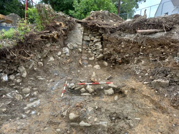
On the western side of the Big River, during excavations for the concrete pad foundation for the bridge sub-structure, two coeval, parallel and abutting masonry walls (C.4 and C.5) were revealed. The walls are related to a dwelling depicted on the 25-inch OS map (1899). The dwelling is not depicted on the first-edition six-inch OS map (1846).
The location of the walls at the river’s edge suggests they are boundary walls that probably also acted as flood defence from the river. A portion of wall C.5 that would be directly impacted by the concrete pad foundation was excavated, while the remainder of wall C.5 and the entirety of wall C.4 were preserved in situ. Finds recovered from wall C.5, comprising sherds of bottle and window glass, sherds of white-glazed ceramics, slate roof tile fragments, red brick fragments and a metal bottle top, indicate a construction date in the late nineteenth/early twentieth century.