2022:080 - ATHENRY: Clarke Street/Cross Street, Galway
County: Galway
Site name: ATHENRY: Clarke Street/Cross Street
Sites and Monuments Record No.: GA084-001
Licence number: 21E0105 ext.
Author: David Murphy
Author/Organisation Address: 3a Westpoint Trade Centre, Link Road, Ballincollig, Cork
Site type: Historic town
Period/Dating: Multi-period
ITM: E 550100m, N 727650m
Latitude, Longitude (decimal degrees): 53.296795, -8.748537
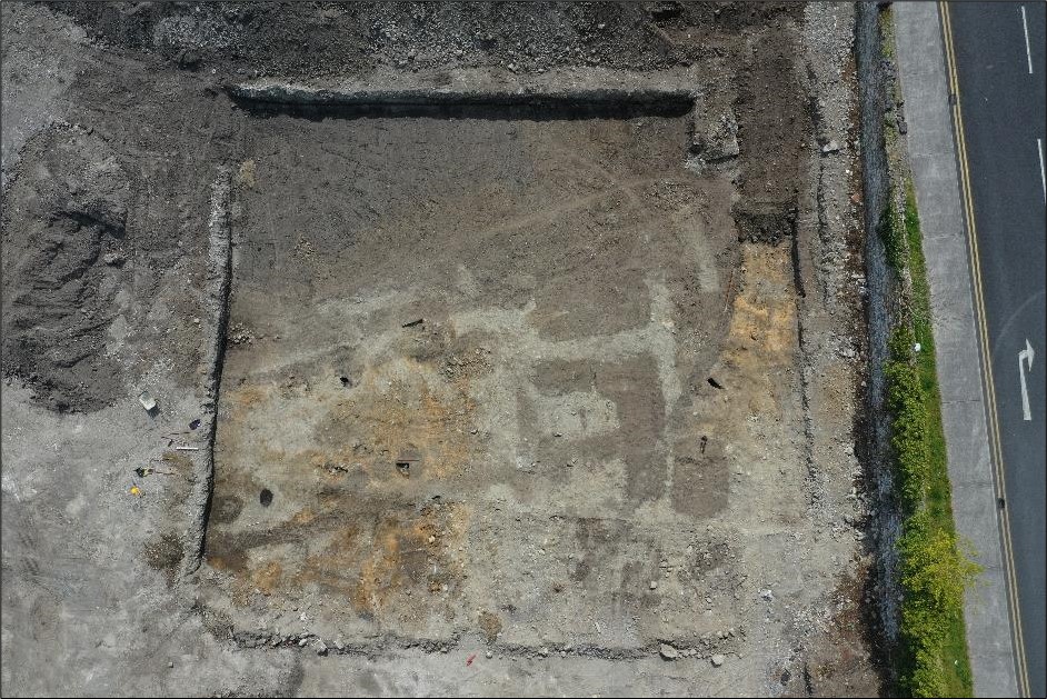
Previous phases of archaeological mitigation had identified areas of archaeological potential within the development site. Phase 2 of testing sought to accurately quantify the nature and extent of any archaeological activity surviving within the footprint of the southern portion of the retail store area (which had been demonstrated to retain archaeological potential, as opposed to the heavily truncated northern portion), as well as the footprint of the attenuation tank location. The footprint of the retail store and attenuation tank are the locations within the site which will be subject to the greatest degree of ground disturbance during construction works.
Activity of archaeological interest was revealed within both test cuttings, however, there was no indication that any of the revealed activity predated the post-medieval period. Both cuttings contained significant depths of garden soil which appear to relate to this site’s former usage as the walled garden of Athenry House. A number of the revealed features appeared to be associated with walled garden activity and contained pottery sherds dating from the 19th century onwards. A number of other features of archaeological interest revealed within both test cuttings appeared to predate the walled garden activity and likely represented post-medieval industrial-type activity. Furthermore, a number of lengthy linear features revealed within both cuttings may represent former property divisions within this area of Athenry.