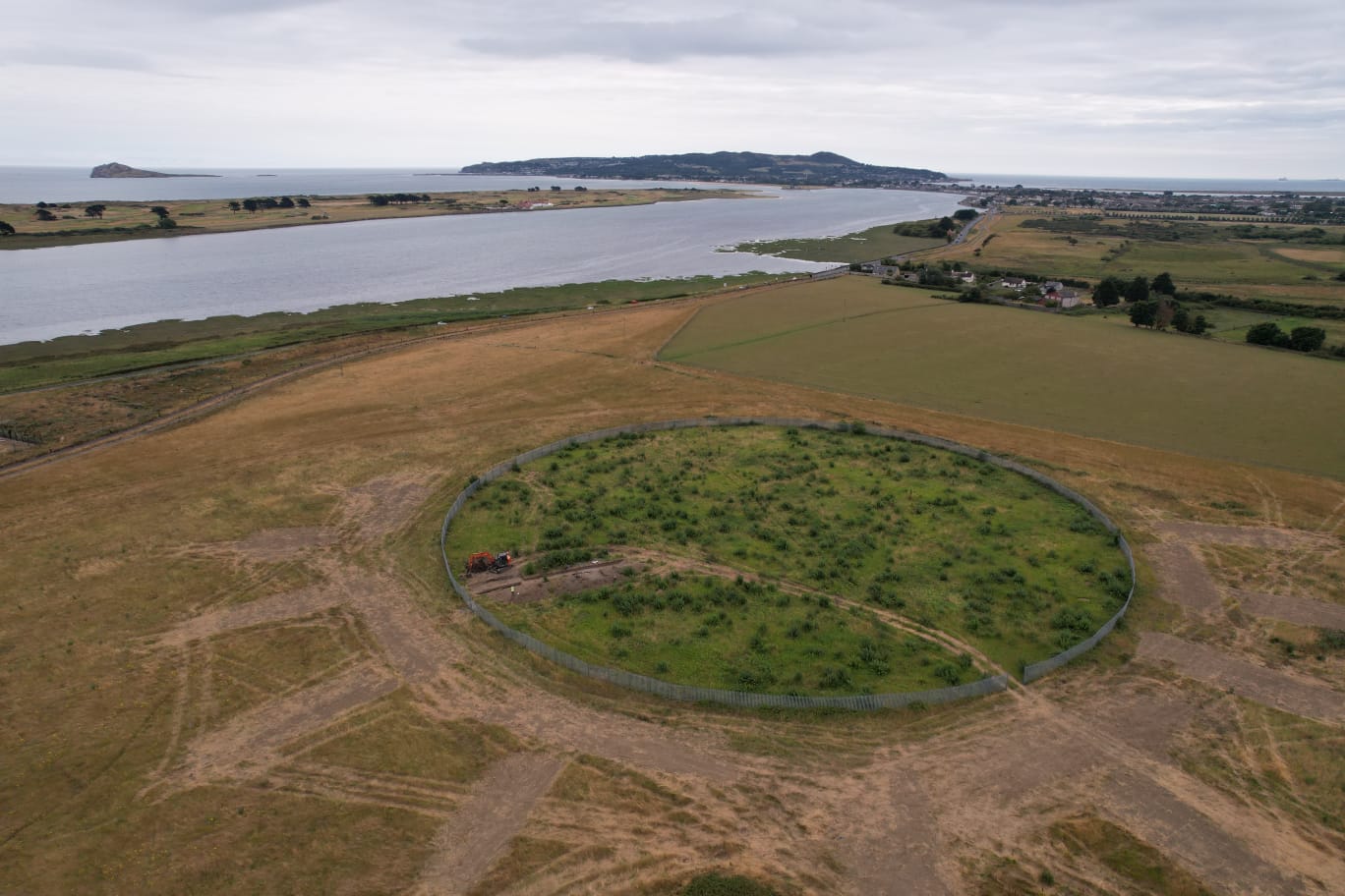
2022:255 - MAYNETOWN, Dublin
County: Dublin
Site name: MAYNETOWN
Sites and Monuments Record No.: DU015-055
Licence number: 22E0509
Author: Gill McLoughlin, c/o Courtney Deery Heritage Consultancy
Author/Organisation Address: Lynwood House, Ballinteer Road, Dublin 16
Site type: Eenclosure
Period/Dating: Early Medieval (AD 400-AD 1099)
ITM: E 723575m, N 741930m
Latitude, Longitude (decimal degrees): 53.413010, -6.141156
Testing was carried out pre-planning, in the vicinity of sub-surface ditched enclosure RMP DU015-055, which is due to be preserved in situ. It follows a geophysical survey of the enclosure and discussions with the National Monuments Service and Fingal County Council in relation to the preservation of the site. The purpose of the testing was to investigate the area surrounding the enclosure in advance of planning for Phases 1E and 1F of a residential development at Portmarnock South, to see if there were any associated archaeological features outside of the existing buffer zone. It was also the aim of the testing to investigate both the enclosure ditch and a pit within the interior of the enclosure to gather information which would assist in the interpretation and presentation of the site.
The testing took place over nine days from 19 July 2022 and the enclosure ditch (7.1m wide) and a large internal pit (8.3m long), as indicated in the geophysical survey, were identified. A deposit of human remains was dumped in the fill of the internal pit having been disinterred from elsewhere.
The deposit of bones represents a minimum of ten individuals including at least five adults and a minimum of five non-adults ranging from 1.5–16 years and cranial trauma was noted in two individuals. The bones were present at 0.4m below current ground level and appeared to have been wrapped or contained somehow, resulting in a linear pattern of deposition (NE-SW) which did not relate to a cut. Animal bones were included within the deposit.
Dating of a sample of animal bone from the secondary fill of the enclosure ditch yielded a date range of cal AD 774–952 and a fragment of human bone yielded a date range of cal AD 674–876.
Two linear ditches and two smaller linear features likely to be associated with sub-surface enclosure DU015-055 were identified in trenches T2 and T3 to the north-east of the enclosure. Ditch C19 was identified in T3 and was oriented west-south-west/east-north-east. It measured 3.3m wide, 1.05m deep and contained three fills, all of which contained seashell and animal bone. Ditch C15 was oriented east-west, measured 2.6m wide and in excess of 0.7m deep. The full depth of this ditch was not reached due to rapid water ingress from below. Three distinct fills were noted, which contained animal bone, seashell and charred environmental remains. The nature of the fills in both ditches suggests that these features were associated with the ditched enclosure.

