2022:917 - RIVER LIFFEY, Dublin Port, Dublin
County: Dublin
Site name: RIVER LIFFEY, Dublin Port
Sites and Monuments Record No.: N/A
Licence number: 22E0007, 22D0001, 22R0003
Author: Rex Bangerter, ADCO
Author/Organisation Address: No. 2, Main Street, Bennettsbridge, Co. Kilkenny
Site type: Excavation - miscellaneous
Period/Dating: Modern (AD 1750-AD 2000)
ITM: E 720534m, N 734298m
Latitude, Longitude (decimal degrees): 53.345159, -6.189784
Marine Site Investigation (SI) was carried out for Dublin Port’s Master Plan 2 (MP2) project, a project which complements the preceding Alexandra Basin Redevelopment (ABR) project, providing capacity for growth in the Ro-Ro Lo-Lo modes (located on the north side and eastern end of the Port Estate), while also ensuring suitable infrastructure for increasing numbers of ferry passengers.
Marine SI works were required to inform appropriate construction design by determining the various stratum types that are present across the development footprint. Both Cable Percussion and Rotary Core techniques are to be used, these being applied as follows:
- Cable Percussive to bore through the upper strata (soil/silt/sand) and
- Rotary Core to bore through substratum, typically comprising glacial till (boulder clay) and sedimentary bedrock.
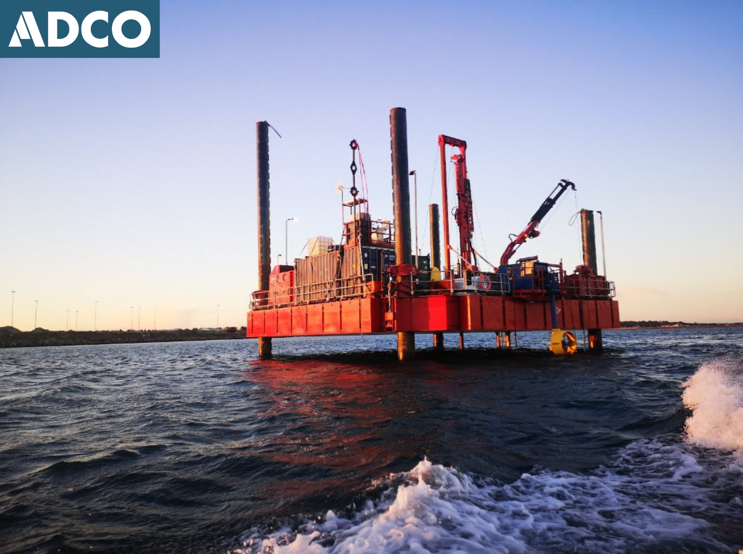
The marine site investigations were undertaken by Fugro over a 43-day period, commencing 11 September 2022. The working platform (jack-up barge) used for the operation was the Fugro Aran 120. The MP2 SI works preceded the Advance Marine SI works carried out for the 3FM project, both programmes being undertaken as part of the same mobilisation and under the same excavation licence.
A total of seventeen marine boreholes and seven cone penetration tests (CPTs) were taken from a series of locations along the northern side of the navigation channel, the investigations being centred on the following areas: to the south of existing Berth nos 50/52, and along the proposed footprint of Berth 53 (travelling east from Berth 52).
The marine boreholes are located across an area of the channel that in the eighteenth-century accommodated the mooring of larger vessels wishing to access Dublin, as depicted on John Roques’s 1757 Map of Dublin Bay, annotated ‘Pacquet Moorings’.
All spoil and samples collected by the on-board geotechnical team were subject to archaeological monitoring. The stratigraphy encountered during the project was relatively consistent, maintained to varying depths from within the main deposit categories. These comprised, Made Ground, Estuarine Sediments, Port Clay, and Glacial Till.
No material, deposits, or structures of archaeological or historical interest were impacted by the site investigations.