2022:788 - DUBLIN 7: No. 20–23 Stoneybatter, and 1–2 Manor St, Stoneybatter, Dublin
County: Dublin
Site name: DUBLIN 7: No. 20–23 Stoneybatter, and 1–2 Manor St, Stoneybatter
Sites and Monuments Record No.: N/A
Licence number: 22E0001
Author: Muireann Ni Cheallachain, c/o IAC Archaeology
Author/Organisation Address: Unit G1 Network Enterprise Park, Kilcoole, Co. Wicklow
Site type: Historic town
Period/Dating: Multi-period
ITM: E 714336m, N 734840m
Latitude, Longitude (decimal degrees): 53.351403, -6.282625
Archaeological monitoring and excavation took place at Nos 20–23 Stoneybatter and No. 1–2a Manor Street, Stoneybatter, Dublin 7.
The earliest feature recorded is the 0.2m-deep layer of medieval garden soil recorded across the site which may be associated with a medieval settlement known as Grangegorman and Grangegorman Manor House (DU018-020565), a manorial centre owned by the Priory of Christ Church located c.100m northeast of the development. The artefactual and faunal evidence from this layer is indicative of domestic occupation of the surrounding area from the late 12th to 14th century and comprises butchered cattle, sheep/goat and a medium sized adult dog and mostly locally produced pottery such as Dublin wares.
John Rocque’s map of 1757 and 1773 shows the development area as partially developed with a terrace of residential structures fronting onto Stoneybatter and Manor Street with rear gardens and probable mews buildings shown. The 0.3m deep layer of post-medieval garden soil recorded across the site is likely associated with the back gardens of the 18th-century terrace of houses or with the Grangegorman Manor house which survived as a residence until at least the 18th century. The rounded base of a mould-blown mineral or soda bottle that dates to the mid-19th to early 20th century and a fragment of pantile dating to the 17th and 18th centuries were recovered from this layer. The Parish Boundary is shown as crossing the development area on the 1757 map and is also marked on the historic OS maps, however no indication of a sub-surface element of this boundary was identified on site.
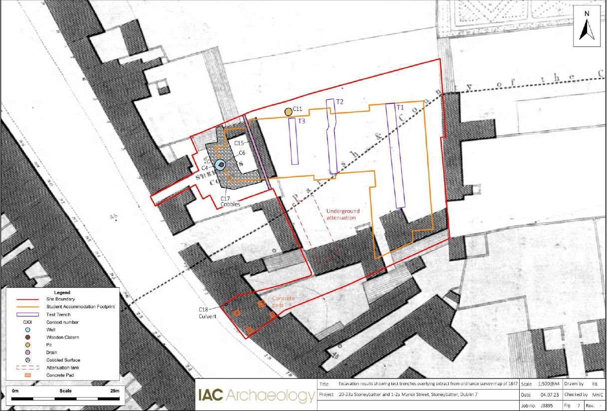
The earth-cut well with a diameter of 2.5m and a possible depth of c.14m with a cistern and vertical water drawing wooden pipes, is located at the rear of the 18th-century terrace and, due to its size, possibly relates to a communal source of water. All the barrel staves were secondary radially-split oak timbers. Oak is generally a common taxon used for the manufacture of structural timbers and smaller wooden functional objects such as barrel staves, as it is a strong wood and is very durable. The water-pipe fragments were rounded and manually bored with an auger and worked into points at one end (the male end) and notched at the other (the female end). The total length of the three water pipes excavated was 14 metres. They were all constructed from pine wood and the pipes were originally used as 18th-century horizontal water pipes and reused here to sump the well up into the barrel as a simple water filter.
The earliest OS map of 1847 shows the development comprising part of a group of buildings labelled ‘Sheridan’s Court’ with a large open space to the rear. The south of the site is also occupied by several structures. The yard surface of Dolerite stone setts recorded across the site likely dates to this period. By the time of the 1864 OS map, Sheridan’s Court is no longer shown within the site. There is little significant change to the southern structures within the site, though a pump is annotated in the south-east corner of the site which may represent the well recorded on site.
All post-excavation works were carried out in accordance with the relevant approvals and in consultation and agreement with the NMS of the DoHLGH and the NMI. Where necessary licences to alter and export archaeological objects were sought from the NMI.

