2022:765 - DUBLIN 1: Railway Court, Railway Street, Dublin
County: Dublin
Site name: DUBLIN 1: Railway Court, Railway Street
Sites and Monuments Record No.: N/A
Licence number: 22E0694
Author: Paul Duffy and Mark Andrews, c/o IAC Archaeology
Author/Organisation Address: Unit G1 Network Enterprise Park, Kilcoole, Co. Wicklow
Site type: Structure
Period/Dating: Post Medieval (AD 1600-AD 1750)
ITM: E 716389m, N 735064m
Latitude, Longitude (decimal degrees): 53.352968, -6.251721
Archaeological monitoring took place of groundworks associated with a development at Railway Court, Railway Street, Dublin 1. This follows a previous Archaeological Assessment report carried out by Joanne O’Meadhra of IAC Archaeology in May 2022.
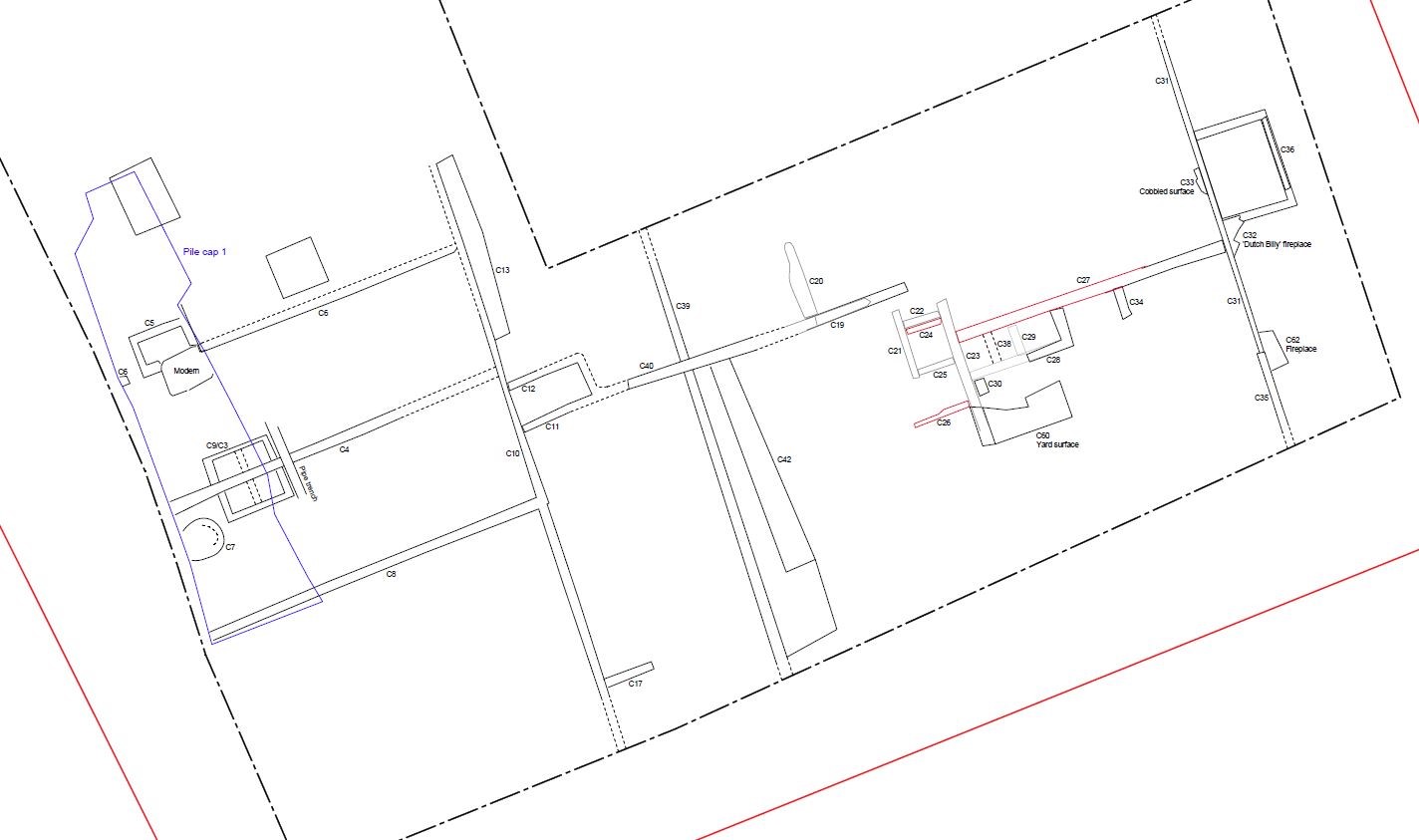
Despite the former presence of the Liberty House Dublin Corporation flat building on the site, considerably earlier structural remains were encountered during ground reduction works. Archaeological monitoring revealed 18th- and 19th-century structural remains along with associated features and deposits. These features were preserved by record down to the formation level which occurred at c. 1.1m below previous ground level. The locations of the piles were then investigated to the level of the natural subsoil and any archaeological features or deposits within these locations was preserved by record. All other features and deposits beneath the formation level and outside of the pile footprints was preserved in situ.
An extensive arrangement of limestone and red brick foundations of walls and other structural features were uncovered. These walls were found to closely match the building layouts depicted on the first edition Ordnance Survey map of 1847. The rear garden plot boundaries of the properties fronting onto Faithful Place were revealed, along with the bases of their associated latrines. At the eastern edge of the site, rooms belonging to the rear of No. 38 Purdon Street were identified. Interestingly, one of these displayed the damaged remains of a corner fireplace suggesting pre-Victorian origins for this grand house. In the south-western part of the site the southern boundary wall of land, shown as an orchard on the first edition OS map, was encountered. This wall, which ran eastwards to meet the western wall of the No. 38 Purdon Street property, had several chambers built up against it and up against another perpendicular wall to its west. These chamber features are believed to be associated with the expansion of a supplies company that is labelled on the first edition OS map and is shown to have had a carriage entrance on Purdon Street. Groundworks did not go sufficiently deep in this area, however, to reveal its sub-structural remains.
The piled nature of the foundations and the absence of a basement to the development enabled a high degree of preservation in situ of the lower courses of the boundary walls and cess pits encountered during the pile mat excavation.

