2022:764 - KINSALEY: Kinsaley House, Chapel Road, Dublin
County: Dublin
Site name: KINSALEY: Kinsaley House, Chapel Road
Sites and Monuments Record No.: N/A
Licence number: 20E0238
Author: Thaddeus Breen; Shanarc Archaeology Ltd.
Author/Organisation Address: Unit 39A, Hebron Business park, Hebron Road, Kilkenny
Site type: Excavation - miscellaneous
Period/Dating: Multi-period
ITM: E 721828m, N 743014m
Latitude, Longitude (decimal degrees): 53.423153, -6.167001
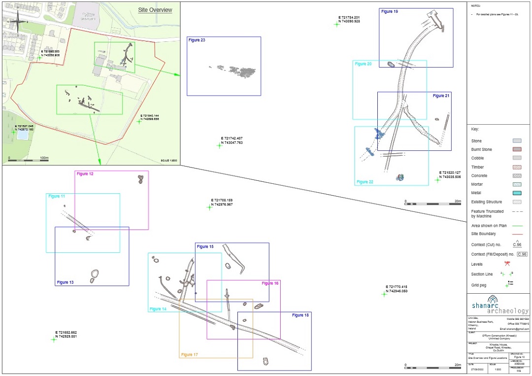
Archaeological excavation was carried out of a number of features exposed during topsoil stripping at the Kinsealy House development in the townland of Kinsaley and county of Fingal.
The development site was previously subject to an archaeological assessment and test excavation by Archaeology and Built Heritage as part of a further information request. Test excavation was carried out under licence 17E0084, during which archaeological features were identified in two areas, subsequently excavated under licence no. 20E0238. The excavations took place in September 2020 and from April to July 2021. The features covered extensive areas to the north and southwest of the 18th-century Kinsaley House.
There were a number of shallow pits, more or less oval, containing animal bones and, especially, seashells. There were also ditches and other linear features, and stone-built drains. Two wells were discovered to the north of the house, one of which had been converted to provide piped water for the house in relatively recent times. An area of paving near the former farmyard was probably also of recent date.
A number of flint fragments were found, but these were debitage from manufacture rather than actual artefacts. Medieval pottery was also present, but it was mostly residual in layers which also contained later material.
The shallow pits and some of the linear features appear to represent prehistoric activity, whereas other linear features, drains and wells are contemporary with the house or its medieval predecessor.
Additional monitoring took place in the south-eastern area of the site on the 3 and 4 May 2022; features found on these dates appeared to be modern.
The position of Kinsaley House within the townland and parish, close to the original parish church, suggests that it has always been the centre of settlement. Monitoring and subsequent excavation have shown evidence of activity at various periods. There were a number of lithic finds. Most, if not all, of these represent by-products of manufacture rather than actual artefacts, showing that flint-working was taking place locally. The lithics are not directly associated with any structural features, but the pits and linear features containing deposits of sea-shells may be of prehistoric date.
Medieval pottery probably relates to a predecessor of Kinsaley House, but the only feature directly related to it was a ditch C.120. The stone structure of a well C.130 may be older than the house, and could be medieval. Ditch C.118, into which it flows, may be medieval in origin, but the finds suggest that if so, it was cleaned out later. Its curving plan suggests that it was adapted from an original feature such as a stream. Other features such as ditch C.071 and the paved surface C.175 are probably contemporary with the present house. The ditch may have been a continuation to the west-north-west of a field boundary marked on the 1st edition map.
It was originally thought that the enclosure of the church (DU015-002001) and graveyard (DU015- 002002) located on the opposite side of Chapel Road to the north of the site, might extend into the field north-west of the house, as the present road bounding the church on the south is a later addition. However, no trace was found of any ditch or other earthwork which would have corresponded to this.

