2022:642 - BLACKROCK: Dal Riada House, Avoca Avenue, Woodland, Dublin
County: Dublin
Site name: BLACKROCK: Dal Riada House, Avoca Avenue, Woodland
Sites and Monuments Record No.: N/A
Licence number: 21E0207
Author: Jamie Lewis & Grace Fegan; Shanarc Archaeology Ltd.
Author/Organisation Address: Unit 39a, Hebron Business Park, Hebron Road, Kilkenny
Site type: House - 19th century
Period/Dating: Modern (AD 1750-AD 2000)
ITM: E 720291m, N 728937m
Latitude, Longitude (decimal degrees): 53.297059, -6.195465
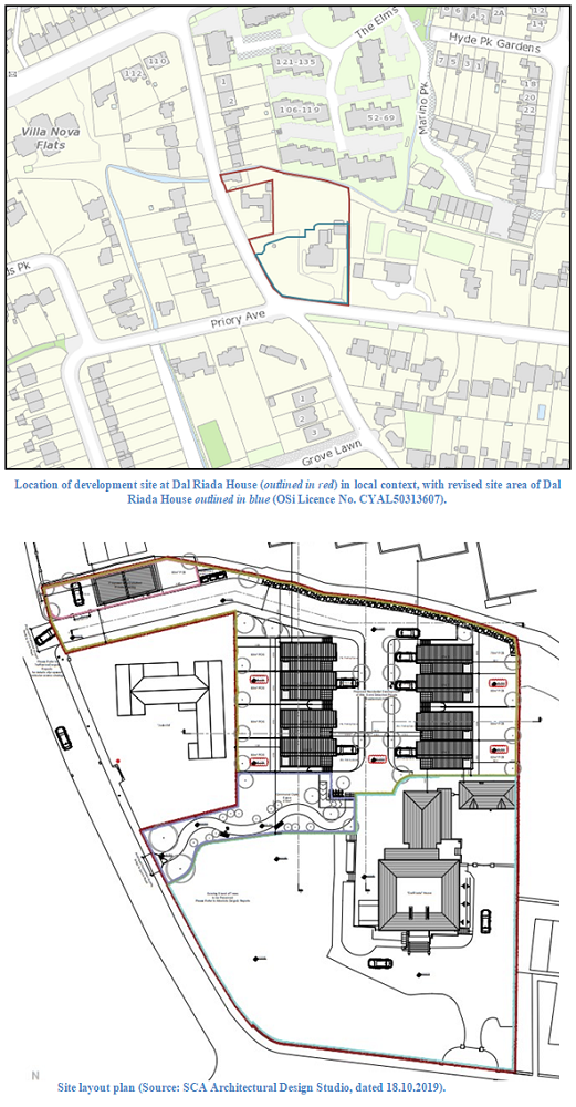
Archaeological monitoring of development related groundworks was carried out on a 0.6-hectare site at the intersection of Avoca Avenue and Grove Avenue to the south-west of Blackrock Village, Co. Dublin. The site contains a protected structure, Dal Riada House, and associated structures, Ref. No. 465 in Appendix 4, Record of Protected Structures, of the Dún Laoghaire Rathdown Development Plan 2022–2028.
Development planning was granted by An Bord Pleanála and Dún Laoghaire Rathdown County Council. Archaeological monitoring was carried out in accordance with Condition 3 of An Bord Pleanala and Condition 16 of Dún Laoghaire Rathdown County Council.
The proposed development comprised conservation repair works to Dal Riada House, including general Coach House repair and removal of a 20th-century lean-to at the rear of the Coach House, as well as the construction of eight two-storey over basement, three-bedroom semi-detached dwellings within the curtilage of Dal Riada House, and the demolition of an existing single-storey dwelling known as Dal Riada Lodge and its replacement with a two-storey three-bedroom dwelling fronting onto Grove Avenue as well as internal roads, landscaping and boundary treatments.
Monitoring was carried out over three days between 30 August and 9 September 2022. Groundworks principally comprised topsoil stripping across the northern half of the Dal Riada House development site, at the location of the residential dwellings to be constructed in the former rear garden to Dal Riada House.
Monitoring commenced at the entrance to the site from Grove Avenue, a narrow strip of ground in the north-west corner of the site. The ground was stripped in preparation for the construction of a temporary haul road. Topsoil comprised a grey-brown garden soil containing bottles, tins and other refuse, and measured approximately 0.4m in depth. Below the topsoil, the natural subsoil comprised a yellow-brown clay. On the first edition 6-inch OSi map (published 1843), a cottage is shown at this location; this was still standing during monitoring, the cottage was enlarged through the 20th century.
Topsoil stripping continued across the rest of the site. The stratigraphy across the wider site was similar to that described above along the entrance from Grove Avenue, with topsoil measuring about 0.4m deep overlaying the natural yellow clay. No intact building foundations were found, but some rubble was present near the north-east corner of the site, where outbuildings are shown on the last historic 6-inch OSi map, published 1940. About 10m to the south-west of this, some fragments of glass panes were found, which are probably from the greenhouses shown at this point on the 1868 town plan series OSi map and on the 1911 25-inch OSi map.
Finds recovered during monitoring comprised various 19th–20th-century ceramic and glass household objects including bottles, plates and two ceramic toothpaste pots.

