2022:640 - DUBLIN 15: Crannach, Granard Bridge, Castleknock, Dublin
County: Dublin
Site name: DUBLIN 15: Crannach, Granard Bridge, Castleknock
Sites and Monuments Record No.: N/A
Licence number: Unlicenced Monitoring
Author: Jamie Lewis & Thaddeus Breen; Shanarc Archaeology Ltd.
Author/Organisation Address: Unit 39a, Hebron Business Park, Hebron Road, Kilkenny
Site type: Building
Period/Dating: Modern (AD 1750-AD 2000)
ITM: E 708308m, N 738105m
Latitude, Longitude (decimal degrees): 53.382002, -6.372009
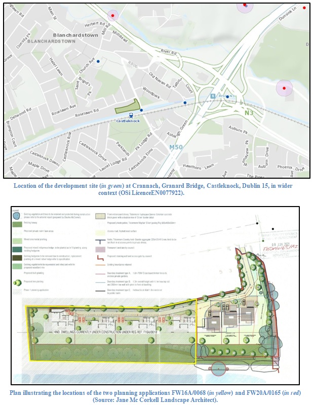
Groundworks on a 0.58ha residential development site at Crannach, Granard Bridge, Castleknock, Dublin 15 were archaeologically monitored in compliance with planning conditions.
The monitoring in relation to a planning grant for the western part of the site took place between 14 and 22 November 2019, and monitoring at the eastern part of the site was carried out between 27 September and 3 October 2022.
The monitored groundworks comprised of the removal of topsoil and made ground, along with the excavation of foundation trenches for the new dwellings at the site. Evidence of modern disturbance and materials associated with the former 1970’s dwelling recently demolished at the site were noted.
No archaeological features, deposits or finds were exposed during the monitored works. In particular, no sub-surface remains of buildings or any artefacts associated with the earlier ‘Rose Lawn’ dwelling at the site were identified.
To the south-east corner of the site, upstanding remains of a rubble stone-walled structure remains in situ at the site. This is understood to be of early 19th-century origin, likely associated with the rectangular building depicted on historic OSi maps on the west side of Castleknock Road near Granard Bridge.

