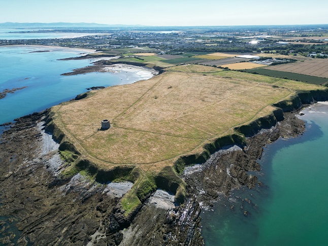
2022:584 - DRUMANAGH, Dublin
County: Dublin
Site name: DRUMANAGH
Sites and Monuments Record No.: DU008-006001
Licence number: C786/E04805
Author: Christine Baker, Heritage Officer/Archaeologist
Author/Organisation Address: Fingal County Council, Main St. Swords, Co. Dublin
Site type: Promontory fort - coastal
Period/Dating: Iron Age (800 BC-AD 339)
ITM: E 727056m, N 756124m
Latitude, Longitude (decimal degrees): 53.539670, -6.083086
Season III of the Digging Drumanagh-Fingal Community Excavation Project
Excavation of a single trench (20m north-south x 4m) took place over 13 days between 17–31 August 2022. The focus of the 2022 season of excavation was to establish the nature of a potential trackway, identified on aerial photographs, geophysical survey and hill shade analysis. The trackway c.10m in width extends from an area at the north-western limit of the headland identified as a possible landing place across the promontory towards the ramparts, c.70m north of the Martello Road. An area of vegetation had been cut in advance of the excavation uncovering a distinct sub-rectangular hollow c.10m north-south x c.7m, not readily identifiable on aerial photographs etc.
Trench 4 traversed the western limit of this hollow. Trench 4 was excavated to subsoil a maximum depth of 0.52m. Aside from a slight dip in the sod layer visible on the west-facing section of Trench 4, there was no evidence of the trackway apparent.
Prehistoric activity and artefacts dominate Trench 4. In the northern 10m of the trench are pits and possible post-holes and uneven depressions which do not form a distinct pattern. A number of potential post-holes transpired to be stone sockets and are indicative of clearance potentially as a result of agricultural activity. The pits were overlain by a layer that was animal bone-rich and contained pottery including an amphora base, worked bone tools, copper alloy pins and a spindle whorl.
There was a distinct concentration of activity located in the southern 10m of Trench 4 which corresponded with the western limit of a rectilinear hollow, identified post-vegetation removal. Interpreted as a structure this activity was characterised by a rectilinear cut with basal metalled surface, packed soil, post-hole, large stone flags and a series of internal occupation deposits. Material of probable Iron Age date and artefacts of Romano-British origin were present in these deposits.
The closest comparison for this structural activity was excavated in Trench 3 in 2019. Interpreted as a working platform the activity in Trench 3 was characterised by a metalled surface, post-hole, large stone flags and a series of animal bone and artefact-rich deposits. A review of this material in light of the 2022 excavation results shows the layout and stratigraphy of both areas of activity in Trenches 3 and 4 are similar. Both are cut/overlying natural subsoil and truncated by later agricultural activity. The elements—basal metalled surface, possible entrance to the north with attendant post-hole, sloping internally, large flags, Romano-British artefacts from internal layers—are notably similar and indicate a structure type. Post-excavation analysis is ongoing.

