2022:469 - INCHICORE NORTH: War Memorial Gardens, Con Colbert Road, Dublin
County: Dublin
Site name: INCHICORE NORTH: War Memorial Gardens, Con Colbert Road
Sites and Monuments Record No.: DU018-020272
Licence number: 21E0727 ext.
Author: Philippa E. Barry, Archaeology Plan
Author/Organisation Address: 32 Fitzwilliam Place, Dublin 2
Site type: Excavation - miscellaneous
Period/Dating: Multi-period
ITM: E 712035m, N 734119m
Latitude, Longitude (decimal degrees): 53.345419, -6.317425
As part of a rejuvenation programme to the Irish National War Memorial Gardens, twenty-six tree pits were mechanically dug on either side of the eastern avenue. Additionally, seven shallow linear slots running parallel to the eastern avenue were dug for the erection of a post and wire fence. These works were subject to an archaeological monitoring brief, on the basis of the Viking era human remains (DU018-020272) and artefacts recovered in 1866, the 1930s and 2004–2008.
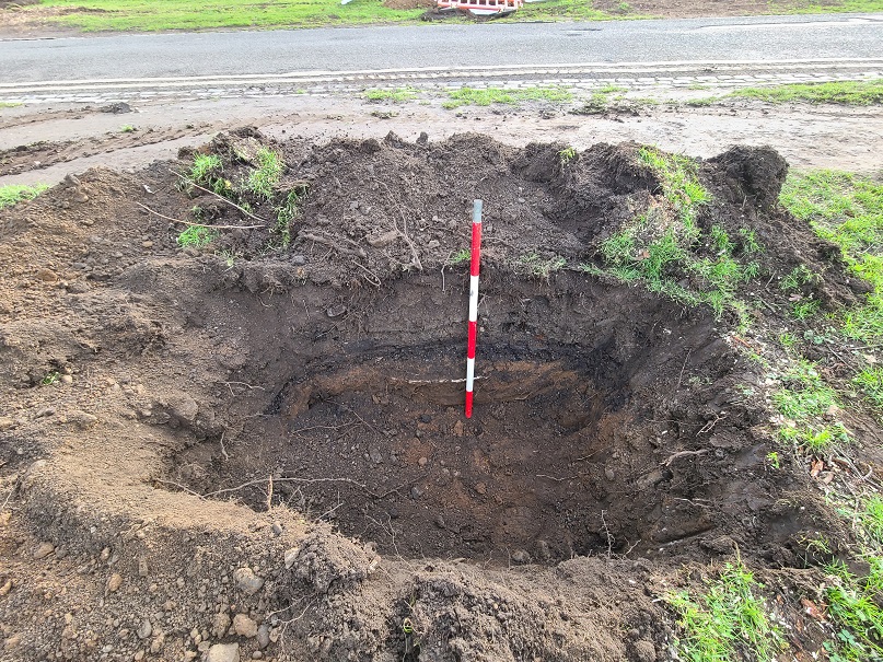
No archaeological remains or layers of archaeological significance were encountered during the course of these rejuvenation works. Evidence of modern disturbance below the topsoil (rubble deposits, dumped material) in the general area was encountered in the majority of the excavated tree-bowl slots, as well as within all seven of the linear slots. A minimum of 17 tree-bowl slots showed evidence of such disturbance, with the most severe impactions found towards the eastern side of the avenue (e.g. TB12 and TB13). On both sides of the avenue, various gravel-mix and hardcore deposits were encountered below the topsoil, likely deposited in association with the construction and maintenance of the eastern avenue.
An orange to brown slightly sandy clay deposit ranging in thickness between 0.19–0.95m was found at the base of 18 tree-bowl slots, in addition to 3 of the linear slots. The clay was found to be sterile in most cases, but the presence of associated animal bone in TB17 and TB19, and the mixed-in rubble deposits in Slot 4 and Slot 5 provided solid counterevidence. The observation of distinct introduced gravel deposits directly underlying this orangish material in TB10 and TB11 additionally support the theory that this material was introduced to the site. Sterile subsoil or natural layers were not reached during the monitoring programme. The greatest depth attained was 1.3m in TB03. The second deepest (1.27m BGL) was in TB13, and was found to be one of the most impacted and disturbed slots, showing evidence for multiple infills/deposits of rubble and gravel.
Further works will be monitored in 2023 under licence 23E0014.

