2022:804 - COMBER: Ballystockart Quarry, 63 Ballystockart Road, Down
County: Down
Site name: COMBER: Ballystockart Quarry, 63 Ballystockart Road
Sites and Monuments Record No.: DOW010:017
Licence number: AE/21/163
Author: Ciara MacManus, Farrimond Macmanus Ltd.
Author/Organisation Address: Adelaide House, Belfast
Site type: Ringfort - rath
Period/Dating: Early Medieval (AD 400-AD 1099)
ITM: E 742674m, N 870585m
Latitude, Longitude (decimal degrees): 54.563458, -5.793819
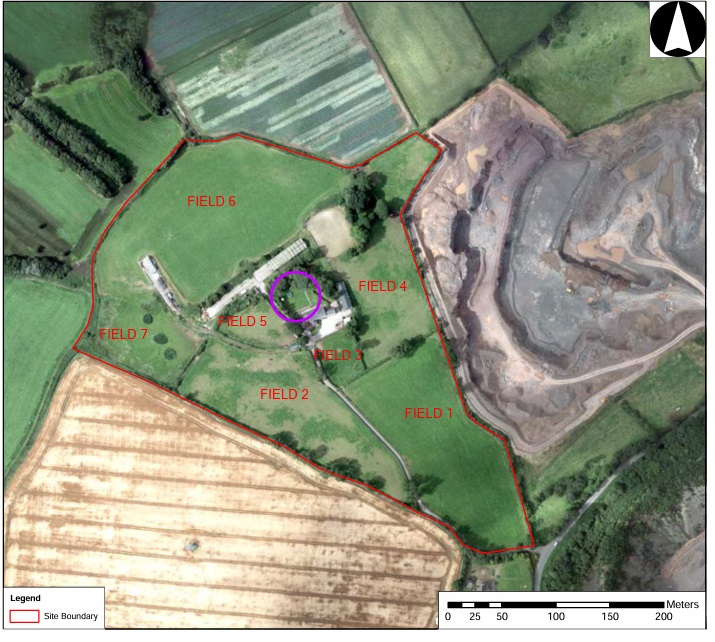
Pre-development archaeological test trenching was carried out in advance of a planning application for a proposed extension to Ballystockart Quarry, Comber, Co. Down.
A total number of 55 trenches were excavated revealing that topsoil directly overlay subsoil across the majority of the site with the exception of a deposit of hill wash discovered to the northeast and east of the site. Test trenching failed to identify any previously un-identified archaeological activity within the majority of the proposed quarry extension with the exception of a small subsoil-cut pit located along the north-east boundary of the site.
Test trenching also confirmed that the existing potential rath (DOW010:017) located within the centre of the site appears has been heavily disturbed by groundworks associated with the modern farm complex. No occupation material was identified within the rath enclosure and while the remains of a ditch were identified along the eastern side of the monument, its exact extent and association with the monument remains unclear given the limited scope for further investigation.