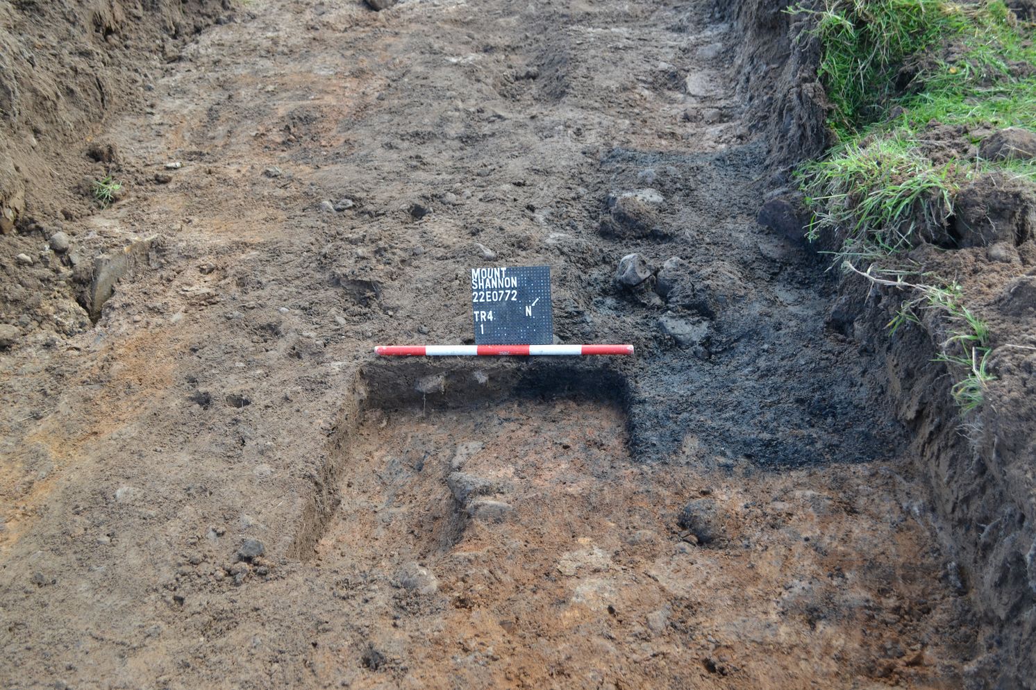
2022:553 - MOUNTSHANNON: Land north of Main Street, Clare
County: Clare
Site name: MOUNTSHANNON: Land north of Main Street
Sites and Monuments Record No.: N/A
Licence number: 22E0772
Author: Kate Taylor, TVAS (Ireland) Ltd.
Author/Organisation Address: Ahish, Ballinruan, Crusheen, Co. Clare
Site type: Pit and Charcoal-making site
Period/Dating: Undetermined
ITM: E 571350m, N 687020m
Latitude, Longitude (decimal degrees): 52.933227, -8.426159
Test trenching of a proposed housing development site revealed archaeological features and deposits across the site, which lies on the north side of Main Street, at the eastern end of Mountshannon village, north-east of St Caimin’s Church. Testing revealed potential archaeological features in two broad areas: on the summit of the hill at the western side of the site and on low ground in the north-eastern corner of the site. No artefactual material was encountered and the features are currently undated. It is likely that other features exist across the site and beyond its limits, particularly to the north-east.
Two similar pits (1 and 2) were discovered, one in the north-eastern corner of the proposed development area (Pit 2), and the other on the summit of the hill at the western side of the site (Pit 1). Both pits appear to be sub-rectangular in plan and contain charcoal-rich deposits; in situ burning was also evident. These features appear typical of charcoal-production pits.
Pit 1 is sub-rectangular, 1.34m long and at least 0.6m wide with shallow sides gradually sloping to a concave base. There is evidence of in situ burning on the base of the pit beneath a single fill of soft, dark grey-black sandy silt with abundant inclusions of charcoal and sparse medium-sized sub-rounded heat-affected stones.
Pit 2 extended beyond the western edge of the test trench with a triangular portion visible in the trench, suggesting it may be the corner of a sub-rectangular feature. The pit had visible dimensions of 1.32m by 0.52m and, in the trench baulk, could be seen to be at least 0.33m deep with steep sides. The upper part of the pit is truncated on its northern side by a furrow and in-situ burning was evident on the pit edge here.
A cluster of potential archaeological features was also noted in the north-eastern corner of the site in the vicinity of Pit 2, a pit (Pit 3), a linear feature and a deposit. A ditch truncates the archaeological features in this part of the site, along with several parallel north-west to south-east aligned furrows, which appear to represent later agricultural activity. The orientation of the ploughing in this corner of the site does not correspond with the current field layout and must pre-date the modern eastern field boundary, but its date is unknown.
The ditch (Ditch 4) aligned north-west to south-east ran parallel to the furrows in this part of the site and indeed had a similar appearance to the furrows prior to the excavation of a slot. Where investigated at its intersection with pit 3, the ditch could be seen to have a very steep side rounding to a flat base. Ditch 4 truncates pit 3, deposit 53 and linear deposit 54.
Deposit 53 was sub-circular in plan, with a length of 2.3m and a minimum width of 1.6m; it was not excavated and the depth is not known. The deposit is firm mid-dark grey brown sandy silt with moderate inclusions of small to medium-sized sub-rounded stones and sparse charcoal flecks. The eastern edge of the deposit, which may represent a large pit, is clearly truncated by ditch 4.
Unexcavated deposit 54 is linear in plan, aligned north-east to south-west and at least 2.6m long and 0.7m wide. The deposit appeared to be truncated by ditch 4 at its south-western end and extended beyond the eastern limit of the test trench. The deposit is a firm mid-dark grey brown sandy silt with heat-affected stone and sparse charcoal flecks visible on the surface along its centre.
Pit 3 was deeper than the charcoal-production pits seen elsewhere on the site but also contains a charcoal-rich lower fill and shows evidence of intensive in situ burning in its base. The oval pit was exposed for dimensions of 1.9m by 1.8m and a small excavated slot revealed steep sides rounding to a flat base at a depth of 0.4m. Pit 3 could also be related to charcoal production, or could potentially be part of a kiln or other domestic or industrial feature.
Both the topsoil and furrows in this area are rich and dark, suggesting that further archaeological material potentially exists in or immediately outside the north-eastern corner of the site and has been incorporated into the ploughsoil through agricultural practices.
It was recommended that the site be subject to full archaeological excavation prior to the development proceeding.

