2022:547 - ENNIS: Ballyortla North, Clare
County: Clare
Site name: ENNIS: Ballyortla North
Sites and Monuments Record No.: CL034-073
Licence number: 22E0531
Author: Kate Taylor, TVAS (Ireland) Ltd.
Author/Organisation Address: Ahish, Ballinruan, Crusheen, Co. Clare
Site type: Ringfort - cashel, Platform and Pit
Period/Dating: Multi-period
ITM: E 539090m, N 678640m
Latitude, Longitude (decimal degrees): 52.855231, -8.904398
Archaeological testing of a proposed single dwelling development located within the Zone Of Notification of ringfort-cashel CL034-073 at Ballyortla North, Ennis, Co. Clare, revealed that there are features of archaeological potential present within the proposal site at its western side, adjacent to the cashel.
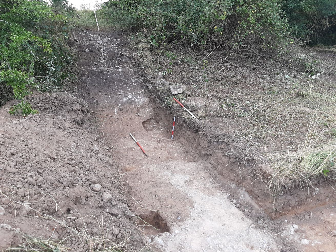
The archaeological features were discovered south-east of the previously recognised extents of the cashel on the edge of a bedrock outcrop on which the monument is built. A stone deposit identified on the top and side of the rock outcrop could be evidence of a collapsed wall or stone bank, suggesting that the bedrock plateau outside the cashel itself may once have been enclosed.
The stone deposit was composed of sub-angular limestone pieces and rocks, varying in size from 0.05m to 0.4m across. The stones were seen to be in a matrix of humic soil, essentially the topsoil and leaf mound mixed into the layer of stones. The deposit was not excavated and its depth is unknown, but it appeared to overlay bedrock.
At the eastern, lowest, edge of the stone deposit, bedrock was exposed, forming a vertical face. Where investigated in detail, it appeared that the rock face here had been modified or quarried. This vertical face formed the western edge of a 2m wide, flat-bottomed ditch that was aligned north to south along the base of the rock face. In the excavated slot the depth of the ditch was seen to be 0.6m at the west against the rock and 0.25m at the east on the flat ground. The drop from the top of the stone plateau to the base of the ditch is almost exactly 2m.
Located just 0.2m east of the edge of the ditch a pit was noted, it appeared as a semi-circular feature extending beyond the southern limit of the excavated trench. The pit was seen to be 1.35m long east to west by at least 0.87m and a small slot excavated at the eastern side revealed a steeply sloping side and depth of at least 0.4m.
It appears that the rock plateau south of the cashel was utilised and potentially enclosed or defended, presumably during the occupation of the cashel itself.
It was recommended that the site boundary be altered to accommodate a buffer zone around the features and that archaeological monitoring be carried out during construction groundworks.