2022:916 - CARLOW: Ballynacarrig Weir, Burren River, Ballinacarrig Td., Carlow
County: Carlow
Site name: CARLOW: Ballynacarrig Weir, Burren River, Ballinacarrig Td.
Sites and Monuments Record No.: N/A
Licence number: 22E0679, 22E0075, 22R0252.
Author: Rex Bangerter, ADCO
Author/Organisation Address: No. 2, Main Street, Bennettsbridge, Co. Kilkenny
Site type: Weir - regulating
Period/Dating: Modern (AD 1750-AD 2000)
ITM: E 673010m, N 675500m
Latitude, Longitude (decimal degrees): 52.825510, -6.916675
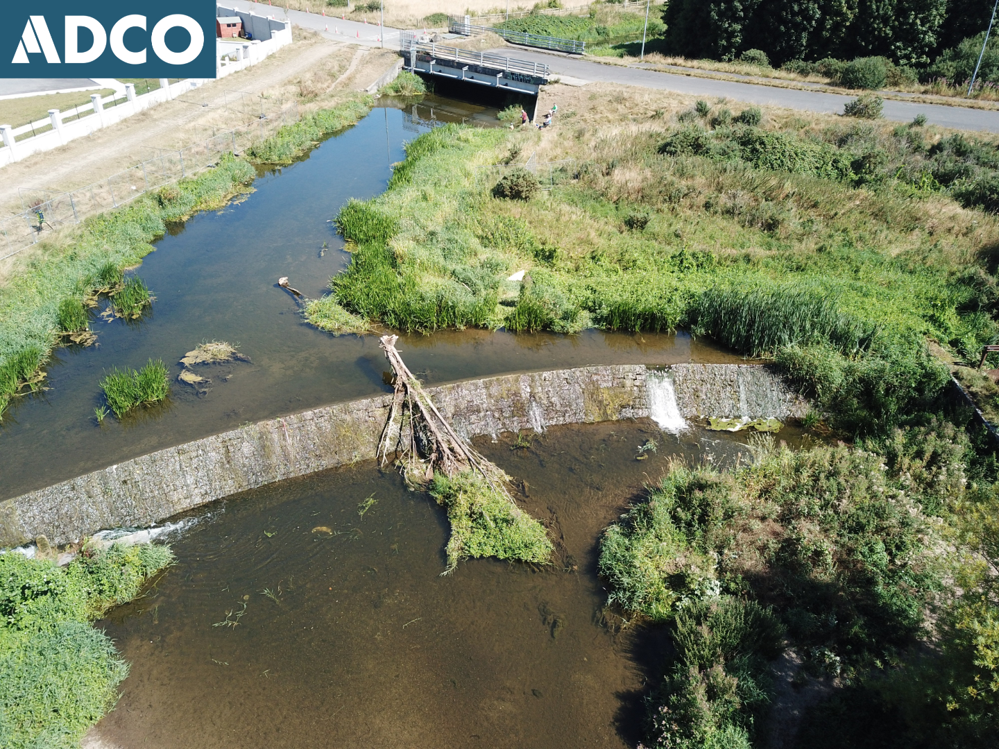
Underwater Archaeological Impact Assessment (UAIA) and subsequent Archaeological Monitoring of in-river and bankside works were undertaken, associated with the Ballinacarrig Weir Fish Pass Scheme. The scheme comprised the installation of a c. 70m rock-ramp fish-pass, on the downstream side of Ballinacarrig Weir, and the creation of a fish-pass opening along the upper part of the weir structure (sill); measuring 13m length by 600mm depth.
The archaeological assessment comprised systematic visual inspection of a 140m section of the Burren River. The survey focused on the Ballinacarrig Weir, which is of early nineteenth-century date, to provide a detailed written/measured account of the structure and its associated features (millrace, fish-pass, and sluice). This work was completed on 10 August 2022.
Riverbed impacts during construction were restricted to the deposition of material (to form a rock-ramp) upon the downstream section of watercourse, rather than the removal of any riverine deposits. As such, only two (2) development items required construction phase archaeological mitigation, these comprised:
- Monitoring of the excavation of 30m long diversion channel (temporary), to be cut on west side of river channel to a depth of 2m.
- Monitoring of the removal of the upper course of masonry (13m-section) from the weir structure to create the fish-pass opening.
Monitoring of all impacts to Ballinacarrig Weir and associated riverine features was undertaken. The removal of the upper course of masonry from the weir’s face (sill stones) was carried out under archaeological direction/supervision. This allowed additional recording of the structure during the removal process. The removed masonry was retained for reuse as part of the project. The archaeological monitoring was completed over a six-day period in late August and early October 2022.
The archaeological work was conducted under DHLGH licence numbers 22E0679, 22E0075, and 22R0252.