2022:614 - CARLOW: Chapelstown, Carlow
County: Carlow
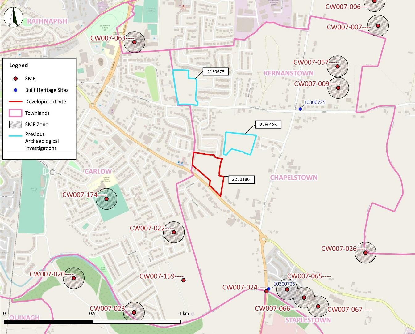
Site name: CARLOW: Chapelstown
Sites and Monuments Record No.: N/A
Licence number: 22E0186
Author: Zbigniew Malek, Archaeological Management Solutions
Author/Organisation Address: Fahy’s Road, Kilrush, Co. Clare
Site type: No archaeology found
Period/Dating: N/A
ITM: E 673944m, N 676067m
Latitude, Longitude (decimal degrees): 52.830478, -6.902691
Archaeological test excavations were undertaken for a proposed development site, Cois Dara 3, in Chapelstown townland situated to the north of Tullow Road and approximately 2.3km east-south-east of the historic town of Carlow. The testing consisted of thirteen test trenches totalling 373 linear metres excavated across the available areas of the site. The testing was carried out on 7 and 8 April 2022.
The site, which measured 2.31 hectares, had functioned for two decades as a building site and storage area, and had been previously disturbed. The topsoil had previously been almost entirely stripped across the site. It was noted within two possible natural depressions located in Trench 2 and in Trench 7. The topsoil comprised dark brown sandy silt with occasional inclusions of stone and was 0.5m deep in these locations. The natural subsoil was exposed up to 0.2m in depth and had been disturbed by heavy machinery and was overgrown across the site. It consisted of loose mid-brownish orange sandy silt with occasional pebble and stone inclusions and patches of loose mid-grey sand and sub-rounded pebbles and stones.
In total, eight linear features comprising three post-medieval/modern field boundary ditches, one field drainage ditch and four field drains of an agricultural nature were revealed in Trench 2, Trench 4, Trench 8, Trench 9 and Trenches 11–13. No archaeological deposits, features or objects were present in any trenches.
Two parallel field boundary ditches orientated east–west, measuring 57.5m long, 0.9–2.0m wide, 0.3m deep and 69.5m long, 1.05–2.0m wide, 0.5m deep respectively, and a parallel field drain measuring 20m long, 0.6–0.76m wide, 0.12m deep were found in Trenches 8, 9, 11 and 12. A field boundary ditch orientated north–south and measuring 3m long, 0.87–1m wide, 0.24m deep was found in Trench 13.
Two parallel field drains, orientated east–west, were found in Trench 4. These measured 2.5m long, 0.8–1.2m wide and 0.18m deep and contained the same single fill. A field drainage ditch and a field drain, both orientated east–west, were found in Trench 2. These measured 5m long, 1.95m wide and 0.26m deep and 4.1m long, 0.8m wide and 0.08m deep, respectively.
All field boundary ditches correspond with the field boundaries depicted on the first-edition six-inch Ordnance Survey map (surveyed 1839, published 1840). The two parallel, east–west orientated ditches are not shown on the first-edition 25-inch Ordnance Survey map (surveyed 1906, published 1908).
Two sherds of undecorated white-ware and one sherd of transfer printed white-ware broadly dated to the post-medieval/modern period were recovered from these agricultural features.