2022:686 - CARRICKFERGUS: McKeen’s Avenue, Antrim
County: Antrim
Site name: CARRICKFERGUS: McKeen’s Avenue
Sites and Monuments Record No.: N/A
Licence number: AE/22/142
Author: Tom Meharg, c/o IAC LtD.
Author/Organisation Address: 9 Stranmillis Road, Belfast, BT9 5AF
Site type: Town
Period/Dating: Modern (AD 1750-AD 2000)
ITM: E 741662m, N 887829m
Latitude, Longitude (decimal degrees): 54.718557, -5.801114
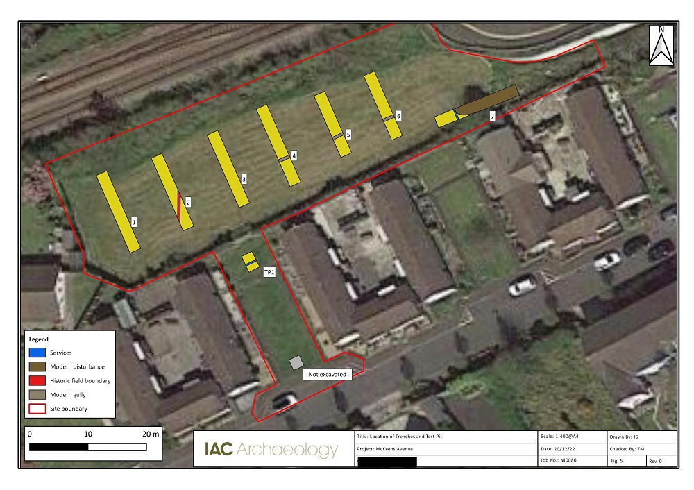
The site was bounded to the northwest by the Belfast to Larne railway line and to the southeast by existing residential buildings. A total of seven trenches and one test pit targeted an area of green space. The evaluation was carried out to ascertain the archaeological potential of the site in advance of a small social housing development. A north–south orientated ditch was identified in Trench 2. This feature corresponds with a field boundary visible on the 1st Edition OS map. 19th-century pottery sherds were recovered from the ditch fill. A shallow east–west orientated gully was identified in Trenches 4, 5 and 6. The feature, interpreted as a small land division, was dated to the 19th century based on pottery returned from the filling deposits. Much of the rest of the site had been subject to modern disturbance related to the construction of the Taylors Avenue road bridge and the installation of modern services.
No features or deposits of archaeological interest were identified.