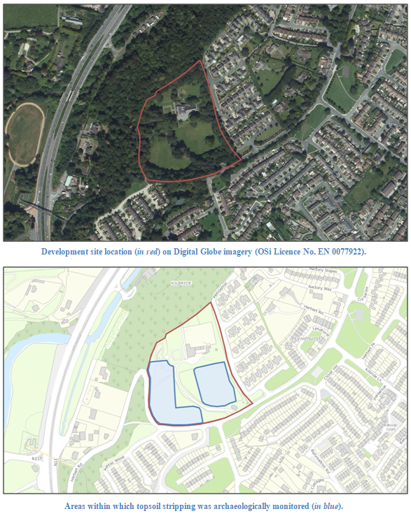
2021:709 - BRAY: Kilbride Hill, Herbert Road, Wicklow
County: Wicklow
Site name: BRAY: Kilbride Hill, Herbert Road
Sites and Monuments Record No.: N/A
Licence number: Unlicenced Monitoring
Author: Grace Fegan; Shanarc Archaeology Ltd.
Author/Organisation Address: Unit 39a, Hebron Business Park, Hebron Road, Kilkenny
Site type: No archaeology found
Period/Dating: N/A
ITM: E 724729m, N 717260m
Latitude, Longitude (decimal degrees): 53.191148, -6.133498
Unlicenced archaeological monitoring of construction-related groundworks was carried out at Kilbride Hill, Bray, Co. Wicklow. Site works are associated with a housing development on the land surrounding Kilbride Hill House. The development was the subject of an Archaeological Impact Assessment Report by Seán Shanahan and Edel Barry of Shanarc Archaeology Ltd, which was submitted in August 2017.
Topsoil stripping within the footprint of the proposed development was undertaken under archaeological supervision between 28 June and 30 September 2021. Some 19th/20th-century garden features associated with the parkland surrounding Kilbride Hill House were noted during ground reductions, particularly in the north-west portion of the site.
Topsoil comprised a rich brown clayey-silt to a maximum depth of 0.55m. Across the majority of the site, topsoil directly overlay natural subsoil, which comprised mid yellow-brown clay with occasional small angular stone. A land drain was observed running north-south in the western portion of the site. In the north-west portion of the site, the ground had evidently been subject to disturbance as a result of landscaping activity. The ground sloped strongly down from east to west where a series of gravel paths and dried-up water features had become largely overgrown and partially filled by soil slump.
Some red brick fragments were noted in the topsoil, likely to have been waste from the construction of Kilbride Hill House. Some metal waste was also noted, interpreted as parts of what would have been parkland fencing.
No finds or features of archaeological significance were uncovered during the course of the works.

