2021:788 - RIVERVIEW, Rathdrum, Wicklow
County: Wicklow
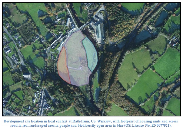
Site name: RIVERVIEW, Rathdrum
Sites and Monuments Record No.: N/A
Licence number: Unlicensed Monitoring
Author: Grace Fegan; Shanarc Archaeology Ltd.
Author/Organisation Address: Unit 39a, Hebron Business Park, Hebron Road, Kilkenny
Site type: No archaeology found
Period/Dating: N/A
ITM: E 719047m, N 688558m
Latitude, Longitude (decimal degrees): 52.934618, -6.229089
Unlicensed archaeological monitoring of topsoil stripping associated with the provision of a housing development in the townland of Rathdrum, Co. Wicklow was carried out on 21–22 July 2021.
Removal of topsoil was monitored across the entire footprint of the area in which the housing units are to be located, as well as along the route of an associated access road.
Conditions were extremely dry and sunny. Topsoil was grey/brown sandy clay to a maximum depth of 0.37m. Across the monitored site, topsoil directly overlay natural subsoil of a mid-orange/brown sandy clay with occasional small and medium angular stone.
The narrow ditch of a removed east-west orientated field boundary was observed, but no features or finds of archaeological significance were identified during monitoring.