2021:235 - BALLINARD, Wicklow
County: Wicklow
Site name: BALLINARD
Sites and Monuments Record No.: N/A
Licence number: Unlicensed monitoring
Author: Grace Fegan; Shanarc Archaeology Ltd.
Author/Organisation Address: Unit 39a, Hebron Business Park, Hebron Road, Kilkenny
Site type: No archaeology found
Period/Dating: N/A
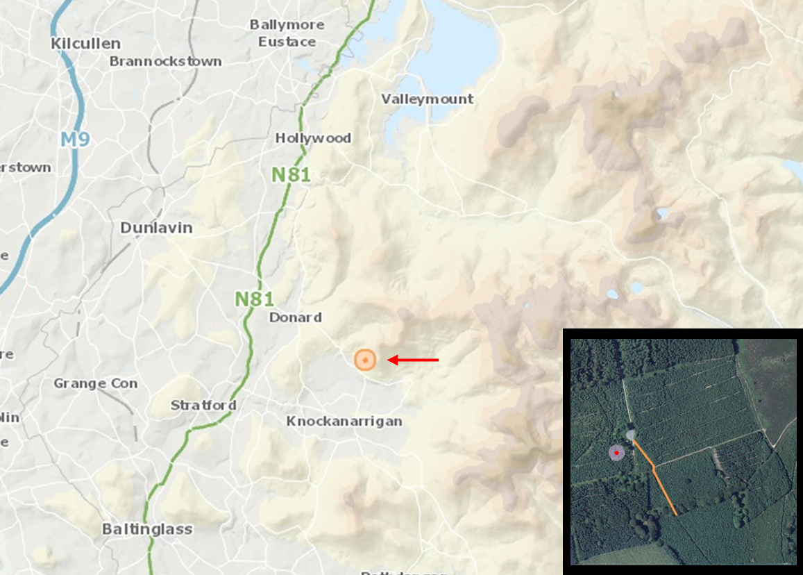
ITM: E 696058m, N 695936m
Latitude, Longitude (decimal degrees): 53.005511, -6.568748
Unlicensed archaeological monitoring of groundworks associated with the improvement of a section of existing forestry road in Ballinard, Co. Wicklow, was undertaken on 6 July 2021.
The monitored groundworks were conducted by Coillte within existing forestry, associated with the development of an approved forest road under Forest Road Licence CN87282, issued by the Department of Agriculture, Food and the Marine. In compliance with the Archaeological Conditions of the Forest Road Licence, all excavation and ground disturbance work in proximity of a recorded monument, WI022-031 (standing stone), were subjected to archaeological monitoring.
The monitored work comprised ground reductions to either side of a section of existing forestry road, undertaken to improve drainage. The works were located within 35m of standing stone (WI022-031), and extended south-eastwards for 90m. An existing forestry road lay between the recorded monument and the monitored works.
Removal of large tree stumps and ground reductions either side of the existing access track running north-west/south-east were monitored.
To the south and west of the track, tree stumps were removed, and the ground was reduced by between 0.2m and 0.5m to a maximum of 2m width from the edge of the existing track. To the north and east of the track, the existing bank was consolidated, and the ground was made level, with no significant ground reduction.
No archaeological finds or features associated with the standing stone, or other previously unknown archaeological activity, were identified during monitoring. A low stone boundary was noted to the north-east of the track, running east-west; there was no evidence of its continuation to the south-west of the track. This feature corresponds with a field boundary illustrated on the historic OS mapping and was preserved in situ.