2021:197 - BALLYMANUS LOWER, Wicklow
County: Wicklow
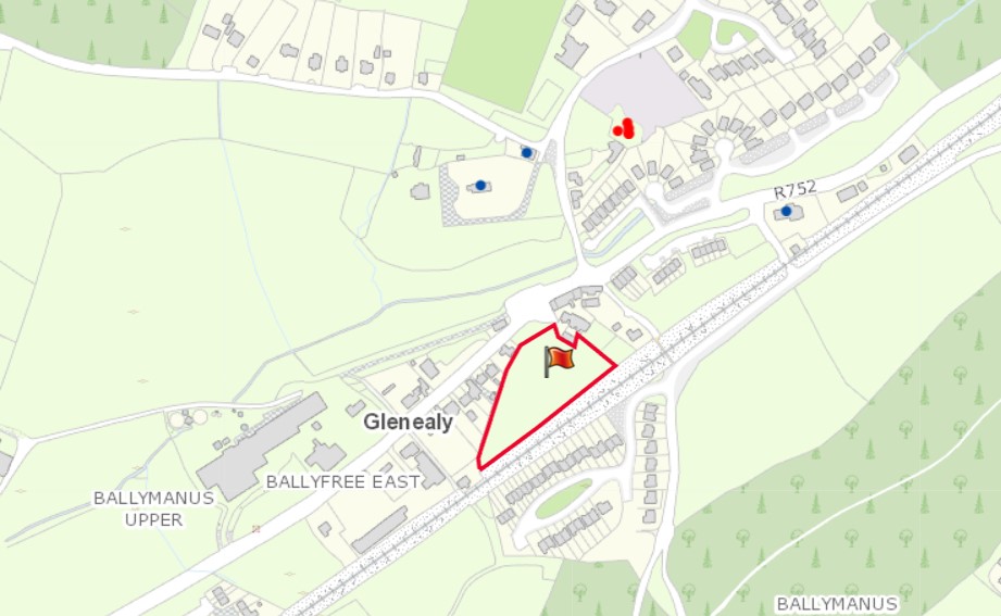
Site name: BALLYMANUS LOWER
Sites and Monuments Record No.: W024-011
Licence number: 21E0743
Author: Yvonne Whitty
Author/Organisation Address: Unit 10 Riverside Business Centre, Tinahely, Co. Wicklow
Site type: Excavation - miscellaneous
Period/Dating: Medieval (AD 400-AD 1600)
ITM: E 724612m, N 692169m
Latitude, Longitude (decimal degrees): 52.965793, -6.144964
The proposed greenfield development site has an area of 1.13ha and is located 200m south-west of W024-011 church, graveyard & ecclesiastical enclosure. The RMP site comprises the ruins of a church (WI024-011001-) of uncoursed rubble surrounded within an earlier circular enclosure (WI024-011002-) which lies within a modern graveyard. It is possible that the existing road network may follow the curve of the inner ecclesiastical enclosure which if this assumption is correct, is 50m north-east of the development site. A possible outer enclosure is visible on historic mapping which would mean that the development site is located between the inner and outer enclosure.
A total of five test trenches were excavated on 2 and 3 November 2021. Although no features of archaeological significance were exposed medieval pottery was recovered from the topsoil as stray finds. Modern pottery and a modern horse harness ring were also retrieved. The ground did not appear to be greatly disturbed, however there are houses and a railway track adjacent the site so some topsoil displacement may have taken place. It is also possible that there may be archaeological features in between the test trenches that have yet to be identified.