2021:059 - KERLOGE, Wexford
County: Wexford
Site name: KERLOGE
Sites and Monuments Record No.: WX042-006001-03
Licence number: 21E0154
Author: Yvonne Whitty
Author/Organisation Address: Unit 10, Riverside Business Centre, Tinahely, Co. Wicklow
Site type: No archaeology found
Period/Dating: N/A
ITM: E 705035m, N 619414m
Latitude, Longitude (decimal degrees): 52.316301, -6.459414
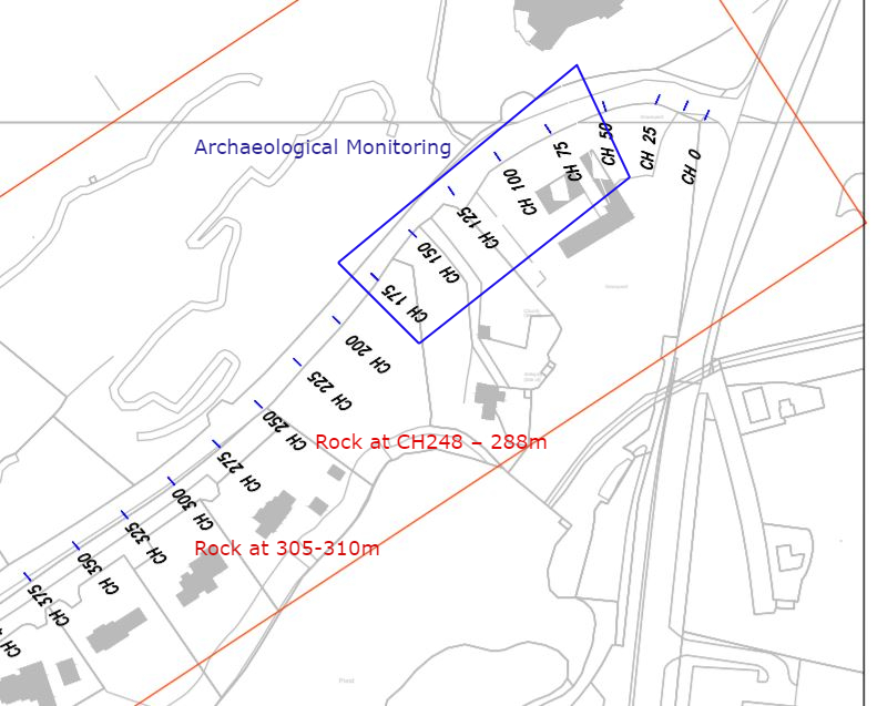
This summary relates to a watermain scheme which will travel north-east to south-west along the Coolballow Road in the townlands of Kerloge, Coolballow and Starvehall.
A cluster of three RMP sites are within 60m of the road where the proposed works will take place; WX042-006001-Church, WX042-006002-Graveyard and a holy well, WX042-006003, all of which are in the townland of Kerloge.
The watermain trench was excavated by machine under supervision to the depth required for the watermain trench (1.2m average). The ground appeared to be made ground between chainages 50-125m, natural ground was not exposed along the length of this trench. This part of the road was higher than the ground to the south and may have been a hollow that was filled in. Natural ground, which comprised sand and rock, was uncovered at 0.15m below the road surface at approximate chainage 130m. Rock was also exposed between chainages 248-288m and 305-310m.
No finds or features of archaeological significance were uncovered in the zone of potential; a modern culvert which was preserved in situ was the only feature identified. No further archaeological mitigation is necessary.