2021:043 - WEXFORD: Mary's Lane, Wexford
County: Wexford
Site name: WEXFORD: Mary's Lane
Sites and Monuments Record No.: WX037-032
Licence number: Unlicensed monitoring
Author: Edel Barry & Michael Greiner, Shanarc Archaeology Ltd.
Author/Organisation Address: Unit 39A, Hebron Business Park, Hebron Road, Kilkenny
Site type: Excavation - miscellaneous
Period/Dating: Modern (AD 1750-AD 2000)
ITM: E 704925m, N 621576m
Latitude, Longitude (decimal degrees): 52.335748, -6.460352
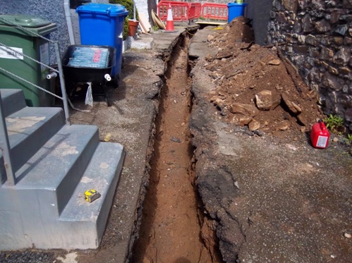
Unlicensed archaeological monitoring of excavation work associated with the rehabilitation of a water mains pipe on Mary’s Lane, Wexford Town, Co. Wexford, was carried out from 12–15 April 2021.
The trench excavation was carried out along Mary’s Lane, north-west of Bride Street. Mary’s Lane is situated within the historic core of the original Viking town of Wexford (WX037-032-), and abuts the curving wall of the historic graveyard (WX037-032033-) of the former parish church of St Mary’s (WX037-032011-).
The excavated trench ran along the centre of Mary’s Lane, starting at Number 5, Mary’s Lane (the house adjoining the graveyard wall, to the north of the proposed development) and finishing at Bride Street at the south of the proposed development. The trench measured 0.4–0.8m in width, 0.8–1.2m in depth, and approximately 30m in length. The row of houses at the south-west side of the street, 1-5 Mary’s Lane, were each connected to the main trench, via small service trenches, measuring 0.3m in width, and 0.6m in depth.
The excavated material comprised redeposited mid-brown sandy gravel. A number of service ducts crossed the trench along Mary’s Lane, and a large number of services were present within the trench on Bride Street.
No finds, features or deposits of archaeological significance were revealed.