2021:708 - WOODSTOWN, near Annestown, Waterford
County: Waterford
Site name: WOODSTOWN, near Annestown
Sites and Monuments Record No.: WA025-072
Licence number: 21E0156
Author: Edward Pollard, The Discovery Programme: Centre for Archaeology and Innovation Ireland
Author/Organisation Address: Unit 2, Merchants House, 27-30 Merchants Quay, Dublin 8, Ireland, D08 K3KD
Site type: Promontory fort - coastal
Period/Dating: Iron Age (800 BC-AD 339)
ITM: E 649963m, N 598697m
Latitude, Longitude (decimal degrees): 52.137872, -7.270124
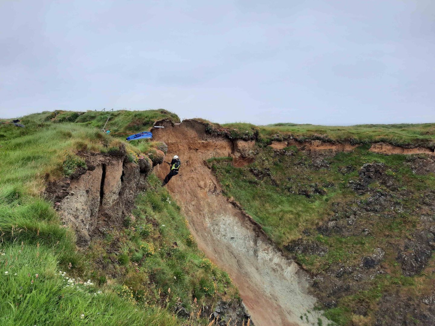
This investigation was undertaken by the CHERISH project as part of an investigation into the erosion of the promontory forts along the Copper Coast of Co. Waterford. This report is on the excavation around the coastal promontory fort of Woodstown, near Annestown. The aims were to record the coastal archaeology before being lost to erosion and test methodologies of cliff-section recording and coring.
Cliff recording was done on the western side of the promontory of the double embankments that are severely eroded with exposed cliff sections. The two banks were built up with material excavated from the two ditches but prior to this being laid down on the bank, a layer of clay was laid down. Rope access recorded the inner bank to be 1.31m high in the cliff section. The cut of the inner ditch is 1.27m deep using the clay layer as the original surface. There is 0.78m depth of sediment at present that has built up in the ditch after the original excavation of the ditch. The outer bank was about 0.22m high from the base of Context 14 to the top of Context 23 but there has been slumping here. Although the outer ditch is not as well exposed as the inner ditch, it was still recorded as having c. 0.66m depth of sediment and is about 1.28m below the clay layer in the bank. Coring showed 1.13m of inner bank material above 0.22m of clay foundation. This makes the bank originally about 1.34m high though there has been some compression from the coring and material has eroded off the top into the ditch. The ditch is 0.66m deep though there was compression in the percussion coring. The outer bank was 0.52m deep below topsoil and lies on 0.12m of clay foundation making a bank around 0.64m high.
A fragment of struck flint, and a sling-shot stone were found eroding out of cliff.
A radiocarbon date from near the base of the inner ditch core has a median probability of AD38.