2021:115 - TEMPLEMORE: River Mall (Templemore) Flood Relief Scheme, Tipperary
County: Tipperary
Site name: TEMPLEMORE: River Mall (Templemore) Flood Relief Scheme
Sites and Monuments Record No.: N/A
Licence number: 17E0348
Author: Tim Coughlan, c/o IAC Ltd.
Author/Organisation Address: Unit G1 Network Enterprise Park, Kilcoole, Co. Wicklow
Site type: No archaeology found
Period/Dating: N/A
ITM: E 610810m, N 671690m
Latitude, Longitude (decimal degrees): 52.796102, -7.839712
Archaeological monitoring of the site of the River Mall Flood relief scheme took place from December 2017 to January 2021. The scheme however passes near to three recorded monuments, TN029-062002 Castle, TN029-062004 Bawn and TN029-062003 House. Monitoring took place over four years spanning 11 areas, the results are summarised below.
Black Castle Road (Monitoring Area 1)
Monitoring was carried out along the existing roadway on Black Castle Road adjacent to TN029-062002. Two trenches were excavated under archaeological supervision. The first trench was excavated to a depth of 1–1.1m and measured 23m x 0.7m. In some areas, there are natural stone boulders which were too heavy to dig; they were avoided and an alternative route for the pipe was chosen. Road surfacing reaches a depth of 0.2m below which a brown clay layer is evident. The second trench was 23m x 0.45m and 1m in depth. It ran through the grass verge on the side of the road. In one location a concrete kerb was recovered from the base of the trench.
Nothing of archaeological significance was identified during the monitoring along Black Castle Road.
Belleville Compound (Monitoring Area 2)
Monitoring was carried out in the townland of Belleville at the site of a compound. The area stripped of topsoil measured 30m x 40m. The topsoil was heavily disturbed as prior to works, the site was in use as an illegal settlement.
An access road was also stripped of topsoil, 6m in width and continuing for 150m running north-east/south-west. A drainage channel to the south of the site, orientated north-east/south-west, was cleared of vegetation and deepened under archaeological supervision. A retaining wall was visible on the east side of the channel which was undisturbed by works and remained in situ. The route of a stream diversion, extending to the drain channel was stripped, measuring 2m in width and 30m in length. Nothing of archaeological significance was identified.
Manna South Compound (Monitoring Area 3)
Archaeological monitoring of topsoil stripping was carried out at the compound site in Manna South townland. An area of 15m x 10m was stripped of topsoil. A drainage channel 1.1m wide and 0.12m in depth was located, orientated north–south. The feature was evident across the excavation and was 9.6m in length and ran into both section faces. Nothing of archaeological significance was found during the course of monitoring in this area.
Woodville River Bank Grading Area (Monitoring Area 4)
An area measuring 260m x 4m on both the east and west of the River Mall north of Woodville was archaeologically monitored. Three drainage channels were identified on the western side of the river running east–west into the river channel. Two of these drains were stone-filled with the third being filled with a stony mid-brown silty clay. The river banks were graded at a 45-degree angle from the water line to the 4m mark. Nothing of archaeological significance was identified in this area of the scheme.
Woodville Northern and Southern Bridges (Monitoring Area 5)
Monitoring took place of topsoil removal on either side of the River Mall for the foundations of two new bridges. The stripped area for the northern bridge measured 4m x 10m on both sides of the river. Monitoring of topsoil stripping for the new southern bridge on both the east and west side of the river was carried out. The area stripped of topsoil was 4m x 10m. Grading of the river bank between the two bridges was also carried out. Nothing of archaeological significance was found during monitoring.
East of River Mall at Manna South Compound (Monitoring Area 6)
An area measuring 199m (north-south) by 120m was stripped of topsoil. Nothing of archaeological significance was found during the course of monitoring.
River Mall Riverbank (Monitoring Area 7)
An area along the eastern riverbank of the River Mall was stripped of topsoil. This was carried out in two sections, north and south of a field boundary. The northern section comprised 50m of riverbank, while the southern section comprised 70m of riverbank. There was nothing of archaeological significance found during monitoring.
ESB Trench (Monitoring Area 8)
It was necessary to relocate electricity lines to accommodate the scheme, this was carried out under archaeological supervision. The topsoil was stripped to clear an area 90m x 4m. The ESB trench was dug to a depth of 0.9m through the natural and at a width of 0.8m
Extension to Belleville Compound (Monitoring Area 9)
An area measuring 60m x 46m was stripped of topsoil to allow an extension to the compound in Belleview (which had previously been subject to archaeological monitoring, Area 2). The land was marshy and a number of modern field drains were identified. Nothing of archaeological significance was uncovered.
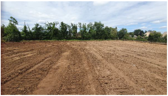
Manna South Deposition Area (Monitoring Area 10)
An area 60m x 35m of the Deposition Area in Manna South townland was stripped of topsoil under archaeological supervision (Plate 1). The northern portion of the proposed deposition area was not included in the area stripped of topsoil.
River Diversion Channel (Monitoring Area 11)
The Diversion Channel route and associated haul road were stripped of topsoil, extending 371m in length and 10m in width. No features, deposits or finds of archaeological significance were identified.
To date, nothing of archaeological significance has been uncovered during the scheme in the areas subject to monitoring. Monitoring is still ongoing as part of the River Mall (Templemore) Flood Relief Scheme and a final monitoring report will be complied on completion of the project.