2021:449 - CLUID AND RATHDOONY MORE, Sligo
County: Sligo
Site name: CLUID AND RATHDOONY MORE
Sites and Monuments Record No.: N/A
Licence number: 21E0352
Author: Zbigniew Malek, Archaeological Management Solutions
Author/Organisation Address: Fahy’s Road, Kilrush, Co. Clare
Site type: No archaeology found
Period/Dating: N/A
ITM: E 564207m, N 817257m
Latitude, Longitude (decimal degrees): 54.103023, -8.547417
Archaeological monitoring of groundworks was undertaken for the Cluid Water Mains Scheme (WMS), Co. Sligo. The scheme forms part of Irish Water’s Water Network Programme to upgrade the existing water network. Archaeological Management Solutions have been engaged as the archaeological consultants for this Programme.
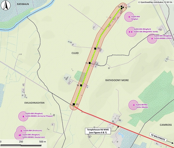
The Cluid WMS was located along an existing local road to the north-west of Ballymote, within the townlands of Cluid and Rathdoony More in Co. Sligo. The monitoring was carried out on 6 and 7 October 2021 and involved the excavation of seven exploratory trenches along the route of the Cluid WMS to facilitate directional drilling or to find existing services.
No potential archaeological finds, features, or deposits were noted during the archaeological monitoring.