2021:546 - MAUDLIN BRIDGE, Kells, Meath
County: Meath
Site name: MAUDLIN BRIDGE, Kells
Sites and Monuments Record No.: N/A
Licence number: 21E0422
Author: Niall Roycroft
Author/Organisation Address: c/o Meath County Council
Site type: Bridge
Period/Dating: Modern (AD 1750-AD 2000)
ITM: E 674645m, N 776850m
Latitude, Longitude (decimal degrees): 53.727464, -6.876841
Maintenance repairs are to be completed on R491 Maudlin Bridge, Kells, Archdeaconry Glebe, Cakestown Glebe and Maudlin townlands. This report is for Monitoring 21E0422 and scanning 21R0169 any risings derived from the limited excavations – a metal detector Elcometer P500 was used to scan any risings from potential riverbed works. Monitoring was completed in September 2021 on behalf of Meath County Council.
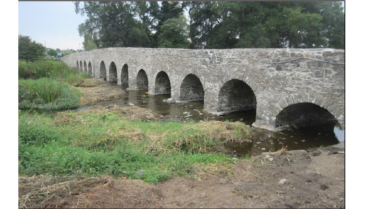
The 13-arch Maudlin Bridge over the River Blackwater is an 18th-century Protected Structure MH017-107 but is not listed by NIAH. The location is not a recorded monument and there are no Recorded sites in the immediate area; the closest, ME017-007 Mound, is c.500m to the south-east. Kells Historic Town ME017-044 is c.800m to the south and south-west.
Maudlin Bridge has been used as a regular fishing location since it was first built and there was potential for all sorts of fishing equipment as well as coins, etc., in and around the bridge. It was considered prudent to archaeologically monitor the works and follow with a report.
Works consisted of damming off 2-3 arches at a time, pumping out the water with the aim of digging a trench c.0.25m wide around each pier before inserting hessian, grout-filled bags. However, many piers were seen to have already had scour protection on them so further excavations were not required. On occasion the upper levels of this previous scour protection was added to during the 2021 works. Excavations were completed with a micro-digger with a 0.25m wide ditching bucket and the excavated material was side-cast over the existing river bed. The damming of the river was not water-tight and the works were usually at or below water level (silt trapping was in place).
Opportunities to metal detect the risings were few and mostly did not arise since the riverbed excavations were limited in depth and these were not removed to a place where metal detecting could take place. Several bridge stones that had fallen into the river were recovered and reused.
Works on the bridge structure were completed in the manner of the approved method statement and no elements that were seen as intrinsically important were damaged or obscured. No archaeological objects were discovered.