2021:003 - KILRUE, Meath
County: Meath
Site name: KILRUE
Sites and Monuments Record No.: ME045-012
Licence number: 21E0022
Author: Gill McLoughlin, C/O Courtney Deery Heritage Consultancy
Author/Organisation Address: Lynwood House, Ballinteer Road, Dublin 16
Site type: Enclosure, Pit and Burnt spread
Period/Dating: Multi-period
ITM: E 704885m, N 749058m
Latitude, Longitude (decimal degrees): 53.481087, -6.419792
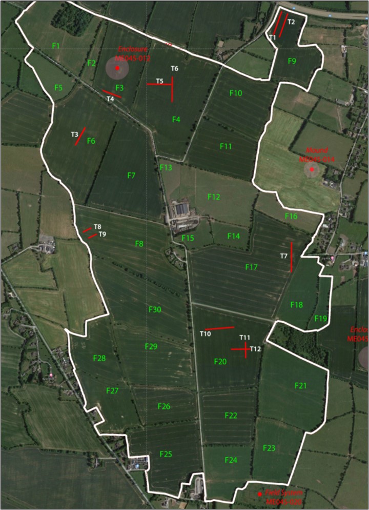
Pre-planning archaeological testing was carried out in relation to a proposed solar farm development at Kilrue, Co. Meath. Testing followed a geophysical survey and focused on areas where an archaeological interpretation or extent was uncertain, to assist with the final layout for the proposed development. Sites identified in the geophysical survey which were clearly archaeological in nature were not tested as these areas are to be avoided by the development. Other areas planned to be excluded from the development were also not tested.
The testing took place over five days from 6 January 2021 and 12 trenches totalling c.1280 linear metres were excavated. Archaeological features were identified at two of the testing areas, in fields 4 and 20. In Field 20, a large ditch was identified at the western end of trench T12 consistent with the enclosure ditch indicated in the geophysical survey (Geophysical Site 19). A small linear feature and a pit further east in the trench are also likely to be associated with the enclosure.
In Field 4, an array of spreads and pits and a small linear feature were identified in the southern end of trench T6 (Geophysical Site 6) and the east end of trench T5/junction with T6 (Geophysical Site 5). In general the features were difficult to define and it is possible that while they appeared as pits and spreads, they could represent a larger feature, such as the enclosure indicated in the geophysical survey.
No dateable finds were recovered from any of the tested features.