2021:512 - SLIEVEMORE, Achill Island, Mayo
County: Mayo
Site name: SLIEVEMORE, Achill Island
Sites and Monuments Record No.: MA042-016
Licence number: 21E0005
Author: Eoin Halpin
Author/Organisation Address: AHC Ltd 36 Ballywillwill Road, Castlewellan Co Down BT31 9LF
Site type: Road - road/trackway
Period/Dating: Undetermined
ITM: E 463736m, N 807311m
Latitude, Longitude (decimal degrees): 53.997045, -10.078330
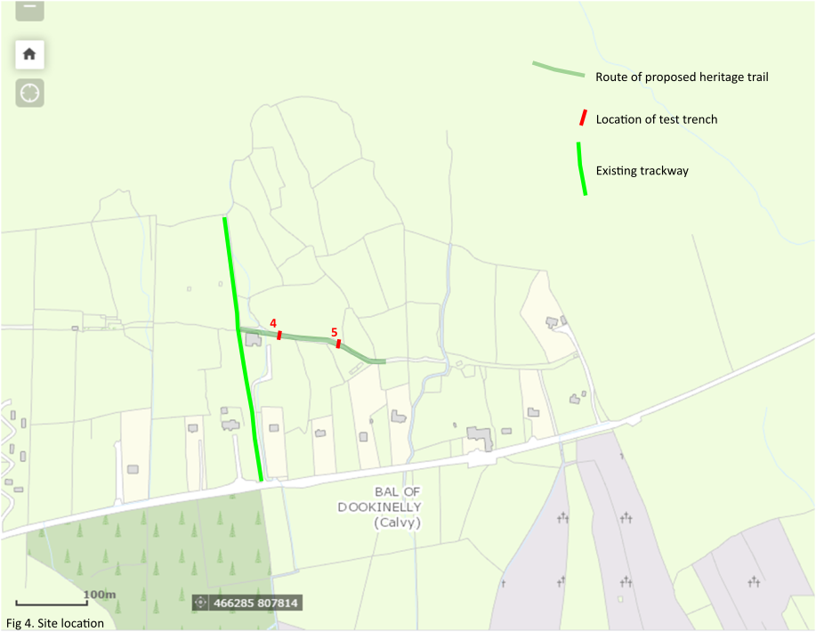
In advance of the details of construction of the proposed Slievemore heritage trail being finialised, it was proposed to address possible archaeological impacts via the hand excavation of five archaeological test trenches, three across the line of the trail route in Tuar Riabhach (Trenches 1-3) and a further two in the trail section joining the existing path to the site of the portal tomb (Trenches 4 and 5).
The test trenching took place over the week commencing 10th May 2021. Each hand-dug test trench was 1m wide and ran north-south across the projected east-west line of the old trackway. Hand excavation continued until the upper surface of the trackway had been exposed or natural glacial subsoil, whichever was encountered first.
The test results show that there are archaeological deposits surviving in situ associated with the old roadway in both the area of the Deserted Village and the area of the portal tomb. The deposits vary from good quality metalled and extensive surfaces, to simpler hard compacted silt clay deposits. However what was clear from the 5 trenches investigated was that there was no consistent surface within the Deserted Village section of roadway or in the roadway closer to the portal tomb.
Perhaps most importantly from the point of view of the proposed construction of the heritage trail, the evidence from the testing suggests that the modern sod ‘overburden’ varies between 100mm and 300mm, the deeper deposits noted in areas that were more marshy in nature.