2021:454 - CARROWGARVE AND BREE, Mayo
County: Mayo
Site name: CARROWGARVE AND BREE
Sites and Monuments Record No.: N/A
Licence number: 21E0550
Author: Richard Gillespie
Author/Organisation Address: Mayo Co Co, Castlebar, Co Mayo
Site type: Road - road/trackway
Period/Dating: Post Medieval (AD 1600-AD 1750)
ITM: E 528856m, N 781995m
Latitude, Longitude (decimal degrees): 53.782663, -9.079512
Most of the greenfield area of the N60 Balla to Claremorris (Heathlawn) proposed development was previously archaeologically tested under licence no. 11E0358. This assessed the archaeological potential of two additional areas. Trenches were excavated to undisturbed subsoil at a standing stone in Carrowgarve townland and an old road in Brees townland. Adjacent geophysical anomalies were also investigated in Brees.
The upright stone had been disturbed by forest harvesting. A test trench was opened across its former location and there was no archaeology present.
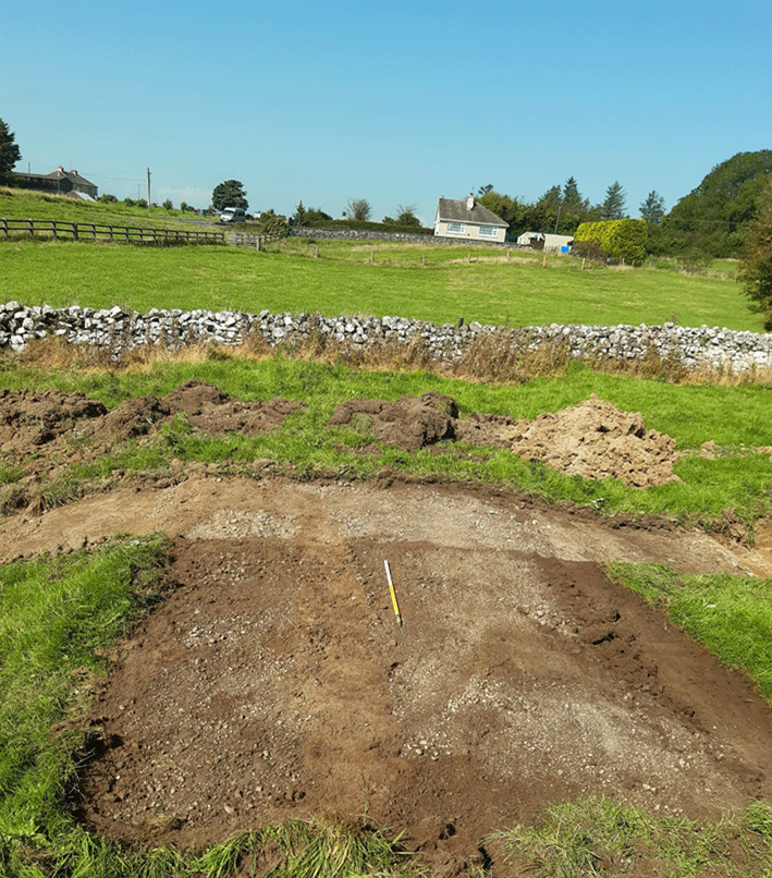
The old road at Brees is a section of an 18th/19th-century road. The earliest available cartographical depiction of this old road is on Bald’s Map as surveyed 1809-1813, which depicts a straight road from Balla passing immediately north-east of Brize Castle and continuing towards Claremorris. The same alignment is visible on the first edition OS six-inch maps (1837-1839). Subsequent maps show a 1.7km section of this road following the roughly parallel alignment of the current N60, to the east-south-east. We can infer from this that the old road, as investigated, was probably constructed in the 18th century and was in use until the latter half of the 19th century.
A 120m section of the old road which had previously been disturbed by a farm/house access road, field boundaries, drainage channels and watermains, will be impacted by the development. The visible remains of the intact sections comprised a 3-4m wide slightly convex embanked road surface 0.25-0.4m above the current field surface. It was flanked by shallow ditches 2.4 -5.5m wide with outer banks.
Two trenches were opened across it at a 90 degree angle to determine its morphology and record the sectional profile. The stratigraphy of the old road was shallow displaying a single phase of construction. A gravel layer, generally 0.1m thick was laid directly on natural subsoil. It was comprised of 20% larger stones 40-70mm diameter, 30% medium stones roughly 30mm diameter and 50% of finer gravel less than 20mm in diameter. This had been evenly spread across the road surface surviving for the road width (3-4m) and present for the road length. This moderately compact layer was overlain by a 0.1m sod and topsoil layer. It was flanked by parallel ditches creating low banks on either side of the road outside the ditches.
Larger stones in the ditches may have been to facilitate drainage or were originally stone from walls that were likely to have been constructed on either side of the old road and later tumbled into the ditches when the land reverted to agriculture. It is also noteworthy that the road surface constituted a thin layer of gravel and small stone which lacked any evidence of wheel ruts or any other contemporaneous wear.
Several geophysical anomalies identified within the test area proved to be non-archaeological and no further features or significant artefacts of archaeological interest were uncovered by this testing.