2021:233 - PALLASKENRY: Shannongrove, Limerick
County: Limerick
Site name: PALLASKENRY: Shannongrove
Sites and Monuments Record No.: LI003-016
Licence number: 21E0799
Author: Grace Fegan & Seán Shanahan; Shanarc Archaeology Ltd.
Author/Organisation Address: Unit 39a Hebron Business Park, Hebron Road, Kilkenny
Site type: No archaeology found
Period/Dating: N/A
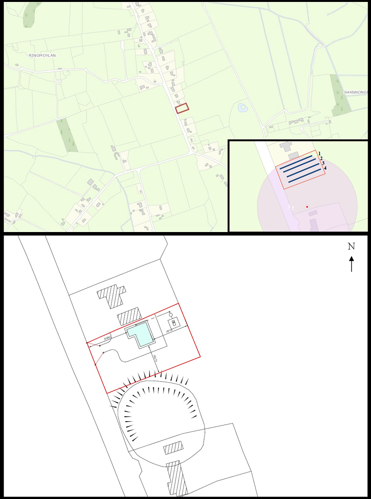
ITM: E 541019m, N 657084m
Latitude, Longitude (decimal degrees): 52.661727, -8.871882
Archaeological test-excavations were carried out on December 6 2021, in relation to the proposed development of a private dwelling at Shannongrove, Pallaskenry, Co. Limerick.
The applicant historically applied to (then) Limerick County Council for a grant of planning under Planning Reference 00/866 (dated 3/11/2000), and was granted permission in 2000. As planning permission under Planning Reference 00/866 has since lapsed, Limerick City & County Council requested that a full Archaeological Impact Assessment and archaeological testing be carried out in support of an updated application to be submitted in respect of the site.
The archaeological potential of the site arises from the proximity of the proposed development to a recorded monument, ringfort/rath LI003-016, the Zone of Notification for which encapsulates the area of the proposed development. No surface traces of the monument are evident.
The development site is enclosed, having a wire boundary fence supplemented with scrub and native hedging, and is of similar size to the adjoining residential plots; several mature trees are also sited along the western boundary. The topography within the site is undulating, with a distinct slope downwards from north to south, and a slope downward from east to west to the eastern boundary.
Four trenches were excavated, Trench 1 at the north of the site and subsequent trenches excavated to the south. The sod layer measured c.0.1m deep. The topsoil layer comprised a mid to dark brown clayey silt with a moderate amount of small sized sub-rounded stones (limestone). This was found throughout the proposed development site. The natural subsoil layer comprised moderately compact, light orange brown gritty sandy silt. A layer of grey compact clay was also noted in each trench, more so in Trenches 2 to 4 and in the east end of Trench 1, east of a modern pit feature. Large sub-rounded boulders were interspersed throughout the site.
No archaeological finds, features or deposits were found during testing.