2021:423 - STRADBALLY RIVER AT CURRACLONE (INCH) BRIDGE, Laois
County: Laois
Site name: STRADBALLY RIVER AT CURRACLONE (INCH) BRIDGE
Sites and Monuments Record No.: LA014-035003
Licence number: 21D0085, 21R0283
Author: Rex Bangerter, ADCO
Author/Organisation Address: No. 2, Main Street, Bennettsbridge, Co. Kilkenny
Site type: Bridge
Period/Dating: Multi-period
ITM: E 660206m, N 198236m
Latitude, Longitude (decimal degrees): 53.031660, -7.102411
Underwater Archaeological Impact Assessment (UAIA) of the Stradbally River at Curraclone (Inch) Bridge, Monaferrick, Inch, and Curraclone townlands, Stradbally, Co. Laois.
The underwater archaeological assessment was carried out as part of the planning requirement identified for proposed remedial works to Curraclone (Inch) Bridge.
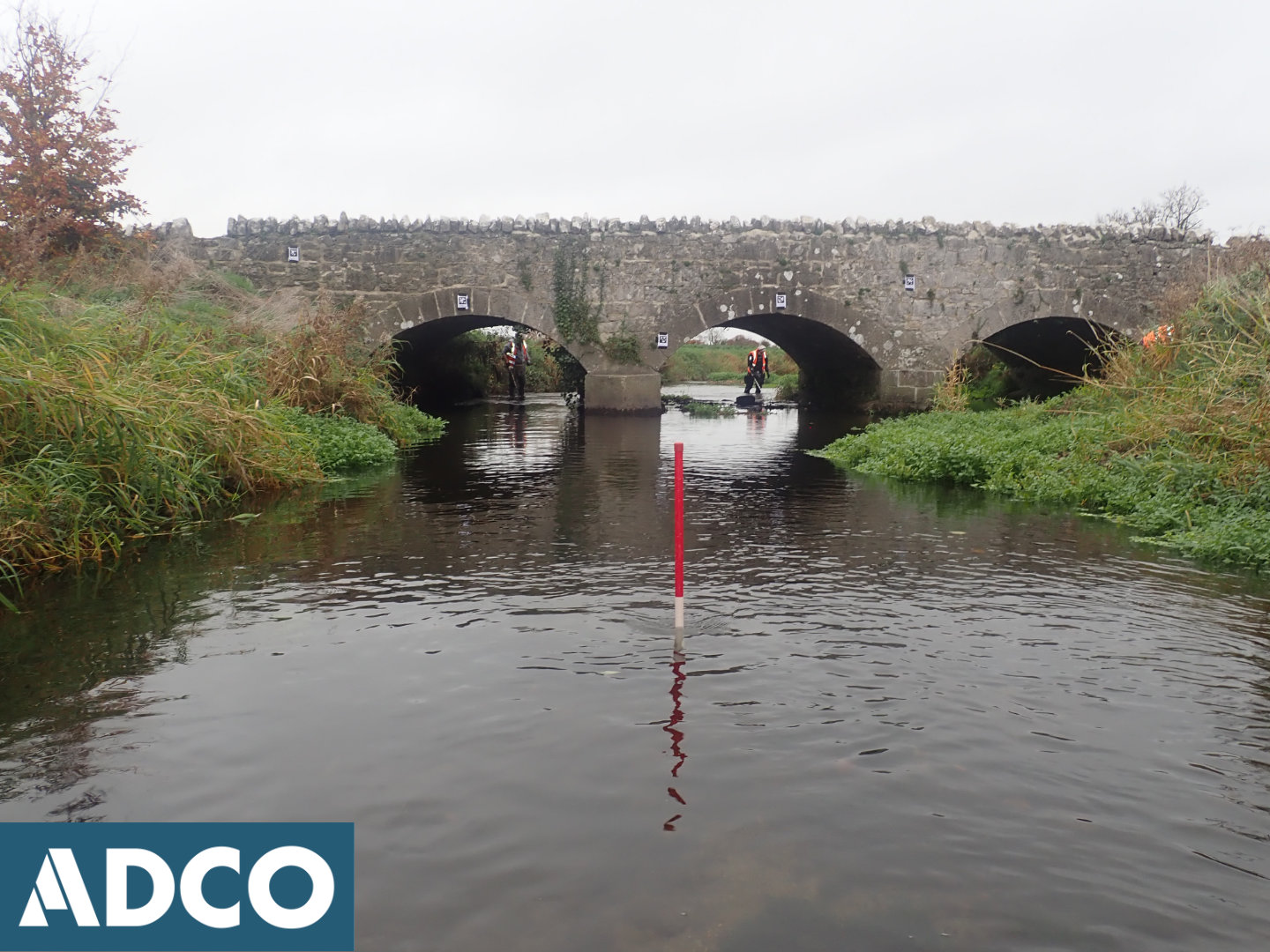
The UAIA comprised systematic visual inspection of Stradbally River, extending 42m upstream and 84m downstream of Curraclone Bridge; comprising a three-arched masonry bridge of late eighteenth- or early nineteenth-century date. The bridge measures 7.25m in width (23.7ft) by 28m (91.8ft). The bridge is not currently listed in the National Inventory of Architectural Heritage (NIAH). However, it is listed in an Industrial Heritage Review of Co. Laois (Ref: LAIAR 014-019).
The proximity of an ecclesiastical enclosure (LA014-035003-) to the site extended the archaeological sensitivity to consider whether elements of the enclosure might reach towards the river bank area. The assessment also sought to provide a detailed account of the existing bridge structure, record riverbed topography, assess the potential of riverbed deposits to retain archaeological material, and identify any additional features/structures of archaeological or historic significance that may be present. This work included a walkover survey of the attendant bank structures and part of an adjacent plough-field, where it is planned to install a temporary works compound. In addition, targeted metal-detection was employed to help assess the riverbed and highlight any metallic concentrations present.
The survey did not observe elements of the ecclesiastical enclosure extending to the riverbank.
Aside from the bridge and its associated features, only one (1) further structure of archaeological or historic significance was encountered; comprising an arched-culvert, located some 80m east-north-east of Curraclone Bridge. While this feature is located outside the assessment area, it is included in this report as its construction is probably contemporary with Carraclone Bridge and it can be considered an associated structure.
Three (3) finds of archaeological/historic interest were recovered as part of the metal-detection survey: a Charles II, Regal (copper) Halfpenny, 1680-1684; a horse-harness fitting (iron fabric), Georgian; and a rare, Late Victorian, Holy Medal from Knock.
The retrieval of these objects confirmed a good archaeological holding-content of the riverbed deposits surrounding Curraclone Bridge. This observation, coupled with the presence of a nearby ecclesiastical enclosure (LA014-035003-), and the fact that waterway forms a townland boundary (Monaferrick, Inch, and Curraclone Tds.), has lent significant archaeological potential to the section of riverbed under assessment.
The on-site work was carried out on 18 November 2021, under licence from the DHLGH.