2021:806 - Gowran, Kilkenny
County: Kilkenny
Site name: Gowran
Sites and Monuments Record No.: KK020-060
Licence number: 21E385
Author: Dominic Delany
Author/Organisation Address: Dominic Delany & Associates
Site type: Town defenses, ring-ditch, pits
Period/Dating: Multi-period
ITM: E 663050m, N 653635m
Latitude, Longitude (decimal degrees): 52.630273, -7.068635
Archaeological excavation and metal detection survey was carried out on a proposed development site at Kilkenny Road, Gowran, Co. Kilkenny, from 7 July to 31 August 2021. The site straddles the line of the town defences in the north-west extent of the medieval settlement at Gowran. The proposed development consists of two blocks, one to the south of the town defences, and one to the north. The blocks will be linked by a footpath which traverses the line of the town defences. This route will also serve as a conduit for all services linking the two blocks.
The south block was partly-developed with access roads, services and house foundations in 2006-07, but the site was subsequently abandoned as a result of the economic crash. Archaeological works undertaken in respect of the 2006-07 development included testing, monitoring, and excavation (2005:804 & 2006:1031). The only remaining undisturbed part of the south block was a narrow strip of land (Wth. 6m) extending north-south adjacent to the east field boundary. This area was topsoil-stripped in 150mm spits to facilitate a comprehensive metal detection survey, which resulted in the recovery of 48 artefacts. Most of the finds were post-medieval personal and domestic items but there were also some fine medieval artefacts including two hammered silver coins and a copper alloy harp tuning peg. A cluster of three large irregular pits (average dims 2.2m x 1.6m) were uncovered in the south extent of the strip. The pits were cut into a localised pocket of deep clay, and were probably used for holding water, most likely for domestic usage. Of the 153 pottery sherds recovered from the pits most were Kilkenny wares with a small number of Leinster cooking ware sherds also present. The discovery of fitting pottery sherds within different pits indicates the pits were backfilled at the same time, most likely in the 13th century.
The North Block was a green field site, displaying a gradual incline from south to north. The only disturbance that had taken place within this field in 2006-07 was the construction of a haul road extending east west across the south extent of the block. The same metal detection survey methodology was employed here and 568 metal artefacts were found, again mostly post-medieval but including over a hundred medieval finds. The only archaeological feature uncovered was an oval pit (dims. 2.3m x 1.8m), which was centrally-located in the south part of the field. The pit contained a single fill which yielded thirty sherds of Kilkenny ware pottery, half of which was identified as Kilkenny cooking ware.
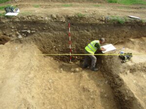
The route of the proposed footpath and services connections was located where services had previously been inserted at the time of the 2006-07 development. The old service trench was re-opened and the corridor was then widened by 2m to the east to facilitate the proposed new footpath and services. A section of the town defences, and the west half of a circular enclosure were excavated. The town defences consisted of a steep-sided ditch, 3m wide and 1.1m deep, containing a series of mostly sterile, re-deposited soils. White’s Map of Gowran 1710-11 suggests the town ditch, which is labelled ’The Rampart or Trench’ on the map, was still open as at this time. A curving linear feature representing the west part of a circular enclosure (min. diam. 6.9m) was uncovered immediately inside the town ditch. The enclosure is delimited by a shallow round-bottomed ditch, 0.9m wide and 0.35m deep, containing completely sterile fills. There was nothing that might suggest a date for this feature but investigations in 2006 recorded a ‘central burial pit’ (2006:1031) indicating this is almost certainly a ring-ditch.