2021:160 - MAYNOOTH: Former Rectory, Parson Street, Kildare
County: Kildare
Site name: MAYNOOTH: Former Rectory, Parson Street
Sites and Monuments Record No.: N/A
Licence number: 21E0410
Author: András Hindli
Author/Organisation Address: Burnside, St. Oran's road, Buncrana, Co. Donegal
Site type: Excavation - miscellaneous
Period/Dating: Multi-period
ITM: E 693672m, N 737374m
Latitude, Longitude (decimal degrees): 53.378231, -6.592142
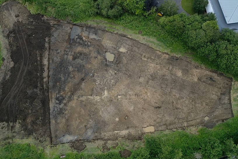
A second phase archaeological testing programme was carried out at the proposed Strategic Housing Development at the Former Rectory, Parson Street, Maynooth, County Kildare. Two cuttings (Cutting 1 – 100m2 and Cutting 2 – 2422m2) were opened on foot of previous archaeological testing (licence no. 20E0254) to comply with a Further Information Request issued by Kildare County Council. The evaluation revealed no evidence of archaeological deposits and, especially Cutting 2, indicated that the subject areas had been used from the post-medieval period as a dumping site that had been reclaimed, containing large areas of waste and disturbance.
It was also noted that the portions of the stripped area were below the water table and subsequently flooded. Correspondingly, all hand-dug sections through linear/ditch-like features were filled by water within minutes. These features may have been associated with the Royal Canal and/or (justifiably) land drainage. The ‘slob land’ nature of the site could also explain the presence of middens and subsequent landfill associated with land reclamation.
Several sherds of pottery ranging from possibly early post-medieval (many of them green glazed red earthenware) to late 20st-century date, and two sherds of potential medieval Leinster cooking ware, were identified out of context across the stripped area. Some residual post-medieval and modern sherds of pottery were found within the fills of the linear features investigated, amongst occasional shell and animal bone. The investigated linear features proved to be ditch-like features and most of them shared the same orientation (north-east/south-west), possibly associated with the Royal Canal and/or land drainage as justified by the flooding issue. The various range of pottery may be connected to the ‘slob land’ nature of the site, hydrology and drainage systems, resulting in ex-situ artefacts throughout the site.