2021:541 - BRIDIA, Kerry
County: Kerry
Site name: BRIDIA
Sites and Monuments Record No.: KE073-055
Licence number: 21E0440
Author: Eugene Costello , University College Cork / Stockholm University & Caitríona Moore, ABH Ltd
Author/Organisation Address: University College Cork & ABH Ltd
Site type: Hut site
Period/Dating: Late Medieval (AD 1100-AD 1599)
ITM: E 479701m, N 582271m
Latitude, Longitude (decimal degrees): 51.979458, -9.751217
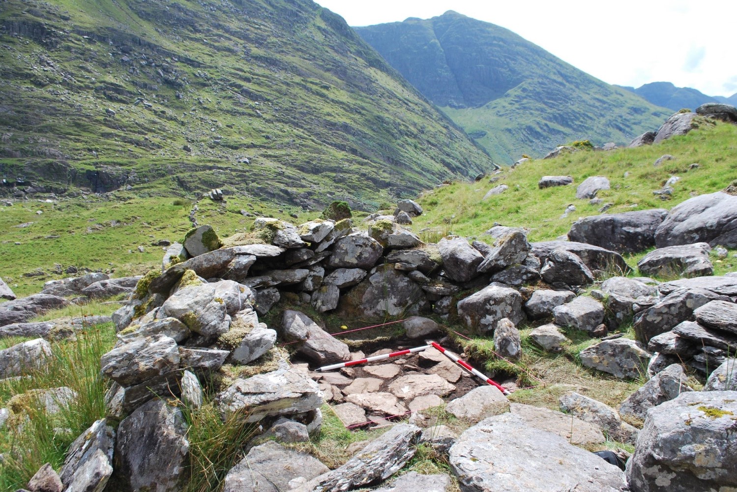
A research excavation was carried out from 31 July to 4 August 2021 on a sub-rectangular stone hut found at an altitude of 295m in an area of rocky upland pasture in Bridia, Co. Kerry. The site is named ‘Bridia 1’ and was first identified by Eugene Costello in 2020 as part of a wider research project on upland pastoralism in the late medieval and early modern periods. The hut almost certainly functioned as a dwelling for herders of cattle, sheep and goats in the mountains, perhaps on a seasonal basis as part of booleying. The aim of the excavation was to obtain material which might help to date the construction and/or occupation of the hut.
A small excavation trench measuring 1.5m by 1.5m was opened in the south part of the hut’s interior. This excavation uncovered a rough flagstone floor that was built on top of the natural soil surface. This floor served as the hut’s primary occupation surface. Several small pieces of wood charcoal were recovered from the contexts immediately below and above this floor. Radiocarbon date ranges for these demonstrate that the floor, and therefore the hut as a whole, must have been constructed prior to the mid- to late-17th century, at the very least, and was most likely constructed sometime in the 16th century.
Over the flagstone floor were several deposits and features. The radiocarbon dates suggest that these relate to a secondary phase of occupation and to post-abandonment collapse over the course of the 18th and/or 19th centuries. One exception is a possible fire-related deposit in the centre of the trench which could have been laid down towards the end of the primary occupation phase (it did not produce any radiocarbon dates, unfortunately). The recovery of two small fragments of likely 19th-century glass confirms that there was renewed activity in the hut in recent centuries, though it is not clear if it was prolonged or fleeting. Higher up in the stratigraphy are stones which have fallen inwards from the hut’s walls. Some of these fallen stones are quite large and, in the north-west of the trench, one even appeared to have partly dislodged an underlying flagstone.
The charcoal record from the excavation provides an interesting proxy of past vegetation in this upland area. Three species characteristic of woodland—hazel, oak, ivy—were found in the layers above the flagstone floor. This is significant as historic OS maps make clear that there has not been any woodland at this altitude in this or the surrounding townlands since at least 1841.

