2021:307 - DROMAGORTEEN (Bonane Heritage Park), Kerry
County: Kerry
Site name: DROMAGORTEEN (Bonane Heritage Park)
Sites and Monuments Record No.: KY102-031
Licence number: Unlicensed Archaeological Monitoring
Author: Niall Gregory
Author/Organisation Address: Dunburbeg, Clonmel Road, Cashel, Co. Tipperary
Site type: No archaeology found
Period/Dating: N/A
ITM: E 495273m, N 565307m
Latitude, Longitude (decimal degrees): 51.830172, -9.519472
The client, Bonane Heritage Park Committee, received grant funding from Kerry County Council to la ay stone chip accessibility path to Bonane Heritage Park, Dromagorteen, Co. Kerry. This project is not subject to a planning application requirement and no notice of archaeological requirement has been issued. However, given the nature of the heritage park, its committee have been pro-active in recognising the potential of the works encountering and exposing archaeological deposits or materials, however small the likelihood, given the specific location, environment and gradient of the works location.
The works took place at two locations Irish Trans Metric 495225 565286 and 495308 565334. The former comprised a footpath circumnavigating an artificial pond at the entrance to the park, while the latter entailed a reduced gradient improved accessibility route into the heritage park. Above-ground mulching to clear scrub and light tree growth commenced on 22 November and ground works (and archaeological monitoring) took place between 26 and 30 November.
Path No. 1, set around the artificial pond and between 2m and 5m from it is between 1m and 1.5m in width. It is 115m in overall length. After mulching by a mini digger, the ground received little or no ground works. For the most part the path was set either on the surface of the existing ground, or materials were introduced to raise the ground surface above existing wet ground.
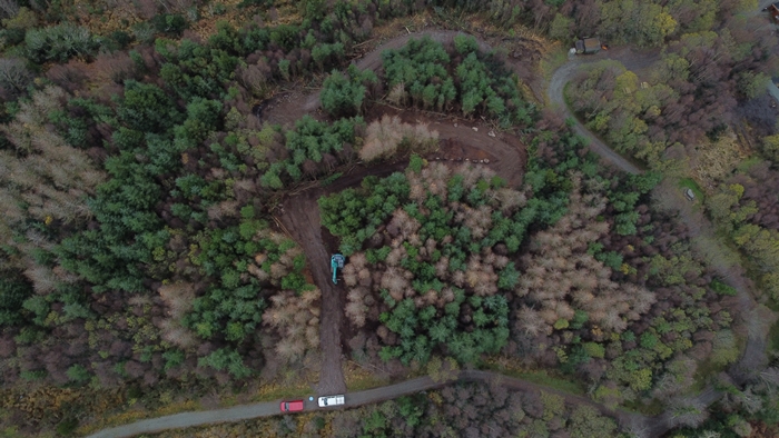
Path No. 2 was set to overcome the steep gradient of the existing access within the western portion of the Park’s grounds. Due to the gradient and tree growth, it was found that both the mulching and mini digger proved impractical for the path. As a consequence a larger track machine with grading bucket was used. This meant that the path broadened to 3m to 3.5m in width.
It involved (from north) an initial southward tributary path, from which it turned to create switch-back element to overcome the steepest part of the gradient, after which it resumed its southward orientation and finally turned to west to meet the existing path at the base of the steep gradient. In all this involved 120m of new path that commenced from the north end as 40m to south-south-east path; turning to west-south-west for 55m; switching back to east-south-east for 55m; then south-west for 45m; finally to west-north-west for 25m. This path involved excavation on uphill (north side) of the new path line of between 0.2m and 1m. the excavated material was deposited on the downhill (south side) to level the path’s cross-sectional profile. As expected, the switch-back portion necessitated the greater amount of excavation. The terrain and stratigraphy consisted of boulder outcrops; 0.2m to 0.6m peat topsoil; onto natural subsoil of orange to pale grey silty sand for the remainder.
No archaeology was encountered.

