2021:191 - GORTACURRAUN (3), Kerry
County: Kerry
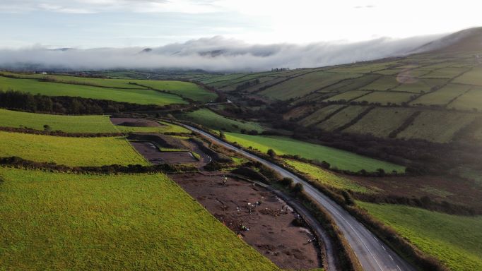
Site name: GORTACURRAUN (3)
Sites and Monuments Record No.: N/A
Licence number: E005291
Author: Niall O'Hora, Archaeological Management Solutions Ltd,
Author/Organisation Address: Fahy’s Road, Kilrush, Co. Clare
Site type: Ring-ditch, Cremation pit and Enclosure
Period/Dating: Multi-period
ITM: E 456695m, N 601280m
Latitude, Longitude (decimal degrees): 52.144760, -10.093872
Stage (iii) Excavation was carried out between 23 November 2020 and 08 January 2021, and again between 06 April and 29 April 2021 at the site of Gortacurraun 3 in advance of construction of the N86 Ballynasare Lower to Annascaul and Doonore North to Ballygarret Road Improvement Scheme, Co. Kerry. The hiatus in the excavation was owing to work restrictions as a result of the COVID-19 pandemic. The work was carried out under Ministerial Direction Number A070 and Registration Numbers E005291 (Excavation) and R000545 (Metal Detection), on behalf of Kerry County Council. The site was discovered in the western area of the Ballynasare Lower to Annascaul section of the scheme in the townland of Gortacurraun during advance Stage (i) Test Excavations undertaken in 2020 by Archaeological Management Solutions Ltd.
Gortacurraun 3 comprised a ring-ditch, a cremation pit, 37 pits, 28 post-holes, 84 stake-holes, twelve deposits, four spreads, one linear feature, two ditches and one agricultural drainage feature.
The ring-ditch was a penannular feature with two opposing entrances in the north-north-west and south-south-east. Both the eastern and western arcs terminated at the north and south. The ring-ditch had an external diameter of 3.1m. The width of the ditch ranged from 0.23−0.52m while its depth ranged from 0.08−0.22m.
The cremation pit was sub-oval in plan, measured 0.82m by 0.71m by 0.16m in depth and contained three fills. Both the secondary and upper fills contained moderate to frequent charcoal, and burnt human bone was recovered from all three fills. The cremation pit was surrounded by several features including seven pits, fourteen stake-holes and two spreads. The stake-holes may represent the remains of a light structure or windbreak.
Located in the north-central area of site was a low mound of small to large sub-angular sandstones which overlaid 22 stake-holes, four deposits and one pit. Twenty of the stake-holes were clustered together. The layout of the stake-holes was broadly circular in plan measuring c.0.92m north-east to south-west by c.0.86m and they possibly represented the remains of a light structure. Overlying these stake-holes was a black charcoal-rich silt deposit which in turn was overlain at its southern end by a second silt deposit containing frequent charcoal and frequent small sub-angular stones. The mound material was irregular in plan, measured 1.98m by 1.1m by 0.1m in depth and comprised small to large sub-angular stones surrounded by a sandy silt with frequent gravel and frequent charcoal flecks.
Approximately 7m to the west-north-west of the mound was a linear-shaped pit that extended beyond the northern limit of excavation. It measured 2.52m by 0.86m by 0.5m in depth and contained thirteen fills. This pit was at the eastern extent of a dense cluster of features that included various pits, post-holes, stake-holes and possible capstones while the pit itself truncated an earlier post-hole.
In addition to the linear pit, the northern cluster also comprised two sets of very shallow intercutting pits which displayed evidence of either in-situ burning or else deposits that were dumped into these pits from nearby burning events. The pits ranged in size from 0.68m by 0.64m by 0.08m in depth to 2m by 1.9m by 0.16m in depth and the two sets of intercutting pits in turn cut a number of earlier pits, post- and stake-holes. These earlier features would appear to be related to a large number of post- and stake-holes in the immediate vicinity of the intercutting pits and probably represent the remains of one or more structures. A total of 20 post- and 30 stake-holes were excavated in this area of the site. One potential pattern amongst the post-holes was a rectangular shape in plan while potential patterns in the stake-holes ranged from circular to linear. Altogether the stake- and post-holes may have been part of a much larger area of activity to the north of the excavation area.
Located at the western end of the northern cluster was a sub-oval pit that measured 1.04m by 0.86m by 0.18m in depth and contained two fills. The pit was encircled by medium to large flat, sub-angular sandstones. Patches of oxidisation and frequent charcoal were recorded in the basal fill, and together with the stone deposit, suggest that the pit may have functioned as a hearth. Seven stake-holes were recorded in close proximity to the south and south-east of the pit and may have functioned as a windbreak.
In the southeastern area of the site was a small cluster of five pits, three post-holes, one stake-hole and one spread. Two of the pits were truncated by a shallow linear feature. In the centre of this cluster was a possible charcoal-production pit that measured 0.9m by 0.82m by 0.19m in depth and contained four fills. The post- and stake-holes likely indicate the presence of a structure.
Two ditches that have been interpreted as representing a possible early medieval field system were recorded along the eastern and southern extents of the site. The ditch at the eastern extent of the site was curvilinear in plan and measured 15.28m in length although it extended beyond the CPO line to the north so its full extent was not recorded. The ditch along the southern edge of the site was orientated south-west/north-east and measured 26.6m in length. A possible honestone and a flint flake were recovered from the basal fill of this ditch.
In the absence of absolute dating, given the nature of the site type, it would not be unreasonable to suggest prehistoric and medieval dates for the archaeology at Gortacurraun 3.
Preliminary post-excavation analysis has commenced, and it is anticipated that this analysis, including radiocarbon dating and comparative research, will further enhance our understanding of this site.