2021:159 - SCRAHAN, Kerry
County: Kerry
Site name: SCRAHAN
Sites and Monuments Record No.: N/A
Licence number: 21E0234
Author: Padraig Dunne, John Cronin & Associates
Author/Organisation Address: 3A Westpoint Trade Centre, Ballincollig, Co. Cork
Site type: Burnt mound
Period/Dating: Prehistoric (12700 BC-AD 400)
ITM: E 506167m, N 628166m
Latitude, Longitude (decimal degrees): 52.396973, -9.378783
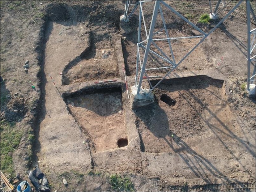
Archaeological monitoring of re-strengthening works of the existing Ballynahulla-Knockanure 220kV overhead power line in north County Kerry involved advanced topsoil stripping for foundation strengthening trenches adjacent to each of the four legs of the existing structures. During the monitoring of topsoil stripping around the legs of Tower 95 in the townland of Scrahan, a deposit of heat-shattered stone believed to represent a burnt spread/mound, was uncovered around Leg 2, the south-eastern leg of the structure. Likewise, a layer of redeposited natural intermixed with burnt spread material was uncovered around Leg 1, the south-western leg of the structure. No burnt mound material was present at the northeast (Leg 4) and north-western (Leg 3) legs of the tower. As it was not feasible to preserve these archaeological deposits in situ, the areas to be impacted by the works programme were subject to full archaeological excavation. The subsequent excavation of an 8m sq. works area confirmed the presence of the truncated remains of a burnt mound/fulachta fiadh.
Post-excavation works are ongoing.

