2021:457 - PROSPECT, Galway
County: Galway
Site name: PROSPECT
Sites and Monuments Record No.: GA084-111
Licence number: 21E0018
Author: Dominic Delany, Dominic Delany & Associates
Author/Organisation Address: Creganna, Oranmore, Co. Galway
Site type: Cross
Period/Dating: Post Medieval (AD 1600-AD 1750)
ITM: E 549549m, N 727380m
Latitude, Longitude (decimal degrees): 53.294317, -8.756759
Pre-development testing was carried out on a proposed residential development site at Prospect, Athenry, Co. Galway between 4 and 8 January 2021. The site is located approximately 250m south-west of the medieval walled town of Athenry (GA084-001).
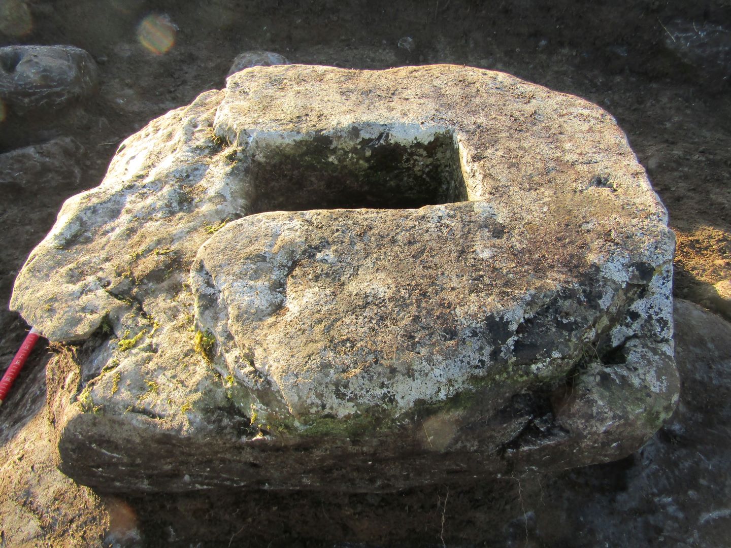
A cross-base (GA084-111) is situated on the highest point of the field within the development site. It consists of a sub-rectangular stone (1m x 0.88m) with a rectangular central socket (0.38m x 0.22m), which would originally have held the shaft of a cross. A raised linear embankment (GA084-113), part of an old road or trackway known as the ‘Bohereenard’, extends north-east/south-west along the south-east boundary of the development site. The development site is also associated with a fair green, formerly known as ‘Parsons Fair Green’ after William Parsons who secured the grant of a weekly market and annual October fair for Athenry in 1629. The socketed stone (GA084-111) is thought to be the base of a ‘Bargain Cross’ associated with the Fair Green. According to Knox and Redington ‘a sale was not clinched until the contracting parties had touched the cross, the ceremony giving a religious sanction to the deal’ (JGAHS XI, 1920).
Testing comprised the mechanical excavation of fourteen test trenches and the excavation by hand of an area measuring 4.5m north-south by 3m on the site of GA084-111 (Cross-base). The test trenches were 2m wide, 25–120m long and generally positioned at 15m intervals. The site topography is one of high ground in the north falling away to lower-lying ground in the south. The stratigraphy generally comprised 0.2m of grey-brown silt topsoil over 0.15–0.3m of orange-brown clayey sand subsoil over grey coarse sand, gravel and stone. No archaeology was found in the trenches. Manual excavations around the cross-base revealed the stone to be 0.2–0.3m thick with the rectangular socket cut all the way through the stone. The stone sits directly on the field surface and not on the large boulder which was exposed just below the surface. All finds from the vicinity of the cross-base are of 19th- and 20th-century date.
Reference
H. T. Knox & A Colleague ‘Notes on the Burgus of Athenry, Its First Defences and it’s Town Walls’, Journal of the Galway Archaeological and Historical Society VOL. XI, No. 1, p9, 1919-1921