2021:611 - MULHUDDART: Damastown Retail Park, Macetown South, D15, Dublin
County: Dublin
Site name: MULHUDDART: Damastown Retail Park, Macetown South, D15
Sites and Monuments Record No.: N/A
Licence number: 21E0661
Author: Marc Piera, c/o IAC Archaeology Ltd.
Author/Organisation Address: Unit G1 Network Enterprise Park, Kilcoole, Co. Wicklow
Site type: Field boundary
Period/Dating: Post Medieval (AD 1600-AD 1750)
ITM: E 705499m, N 741543m
Latitude, Longitude (decimal degrees): 53.413455, -6.413064
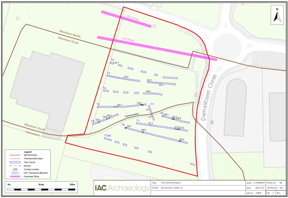
A programme of test trenching took place on 21 October 2021, at Damastown Retail Park, Mulhuddart, D15. A total of 10 trenches were excavated across the area of the development measuring a total of 669 linear metres. Two field boundaries cross the site east to west and divide the site in three fields: northern, middle and southern fields.
Due to the presence of overhead power-lines in the northern field, trench T1 was relocated to the southern field. Trenches in the central field were shortened or tested by means of trial pits due to the dense vegetation and the compact modern backfill in this area of the site. T2, T4 and T10 were excavated by trial pitting and revealed nothing of archaeological significance.
T7 was positioned to target the townland boundary between Damastown and Macetown South. The townland boundary is oriented east–west traversing the site. Eight depositional layers were noted during investigations of the townland boundary, with the upper deposits containing occasional tree roots and small stone. The lower deposits contained more frequent and larger sub-angular and angular stones. Plough soil was recorded within the townland boundary, across the majority of the trenches.
Test trenching uncovered numerous field-drains throughout the investigation area. Both stone and earthen drainage features were noted. Several ditches of agricultural origin were also discovered in the middle and southern fields. There was no archaeology found during site investigations.

