2022:309 - COOLSCUDDAN: Grange Castle Media Park, Dublin
County: Dublin
Site name: COOLSCUDDAN: Grange Castle Media Park
Sites and Monuments Record No.: N/A
Licence number: 20E0486
Author: David Bayley, c/o IAC Archaeology Ltd.
Author/Organisation Address: Unit G1 Network Enterprise Park, Kilcoole, Co. Wicklow
Site type: Burnt mound, Kiln, Hearth and Enclosure
Period/Dating: Multi-period
ITM: E 700636m, N 731794m
Latitude, Longitude (decimal degrees): 53.326822, -6.489288
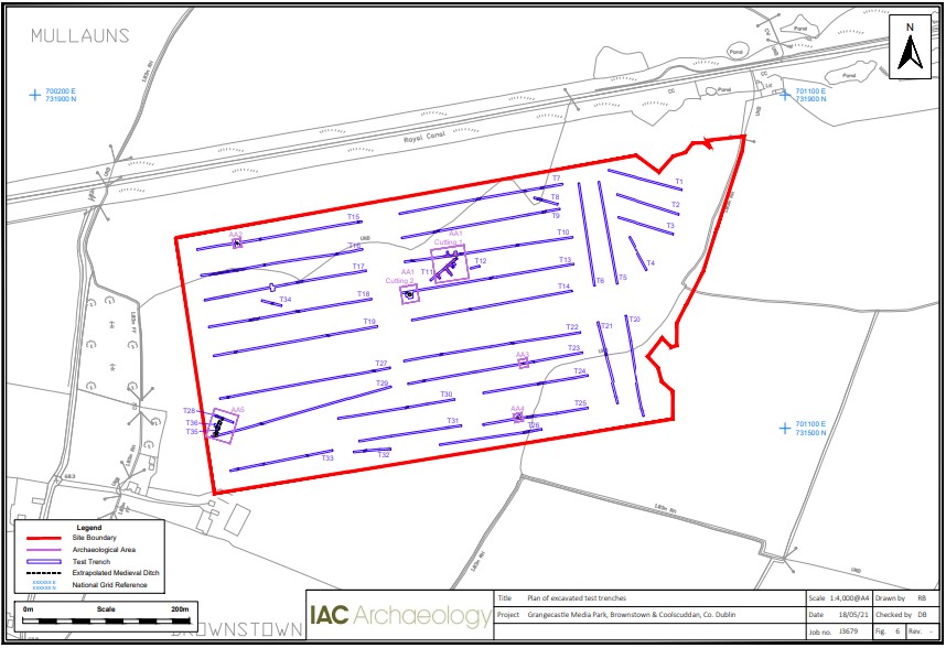
A programme of archaeological testing was carried out over the course of nine days from 22 April 2021. The trenches targeted geophysical anomalies and open greenfield space within the proposed development area.
A total of 5 Archaeological Areas (AA1-5) were identified during the course of testing.
AA1, located centrally in the northern half of the site, revealed the largest concentration of archaeological features, consisting of multiple burnt mound spreads with associated troughs and pits (Trenches 10, 11 and 13). The second area (AA2) was located in the north-west of the site and consisted of a pit filled with material similar to that found in a burnt spread. The third and fourth areas of potential (AA3 and AA4) were located towards the south-east of the site and both areas consisted of isolated hearths or kilns. The fifth area (AA5) was located in the south-west of the test area and consisted of a ditch from which medieval pottery sherds were recovered.

