2021:567 - KILBRIDE: Profile Park, Dublin
County: Dublin
Site name: KILBRIDE: Profile Park
Sites and Monuments Record No.: N/A
Licence number: 21E0692
Author: Marc Piera, c/o IAC Archaeology Ltd.
Author/Organisation Address: Unit G1 Network Enterprise Park, Kilcoole, Co. Wicklow
Site type: Pit
Period/Dating: Undetermined
ITM: E 703681m, N 730561m
Latitude, Longitude (decimal degrees): 53.315158, -6.443999
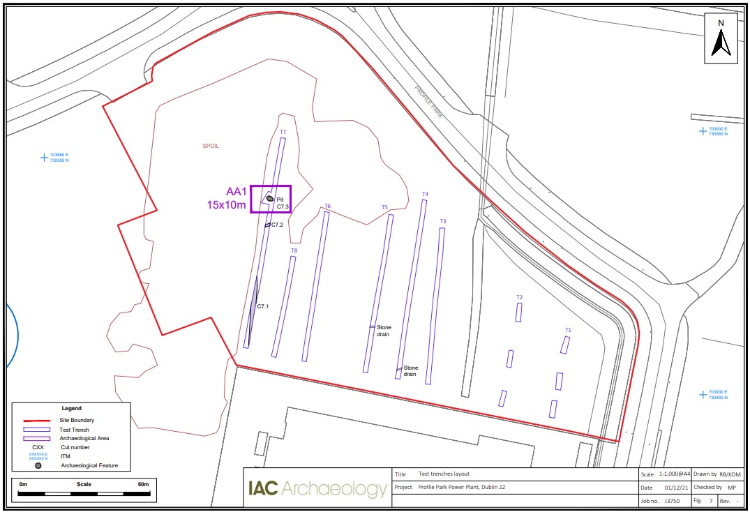
Archaeological testing was carried out on 4 November 2021. Six trenches and six trail pits were excavated across the site measuring in total 382 linear meters. The trenches targeted open green space to fully investigate the archaeological potential of the site.
Testing revealed one area of archaeological significance, which has been designated as Archaeological Area 1. It consists of an oval pit filled by a light grey plastic silty clay-marl with frequent inclusions of charcoal and animal bone. It may represent a waterlogged pit, possibly a well or cistern.
Spoil from a third party covered the north and north-western area of the site which prevented test trenches from being excavated in this area. The eastern area of the site had around 2.5m of modern backfill consisting of different layers of gravel and concrete blocks and with 0.2m of topsoil, which lead to the scaling back of test trenches.
A total of three stone drains were recorded across the site. Some of them may represent the same drainage features running across several trenches. A stone drain was recorded in two trenches.
One ditch was observed along the site, at the southern end of Trench 7. This ditch is interpreted as being made for agricultural purpose, and may represent old field boundaries or drainage ditches.

