2021:485 - PORTMARNOCK, Dublin
County: Dublin
Site name: PORTMARNOCK
Sites and Monuments Record No.: N/A
Licence number: 20E0180
Author: Gill McLoughlin, c/o Courtney Deery Heritage Consultancy
Author/Organisation Address: Lynwood House, Ballinteer Road, Dublin 16
Site type: Pit
Period/Dating: Early Medieval (AD 400-AD 1099)
ITM: E 723165m, N 742150m
Latitude, Longitude (decimal degrees): 53.415082, -6.147233
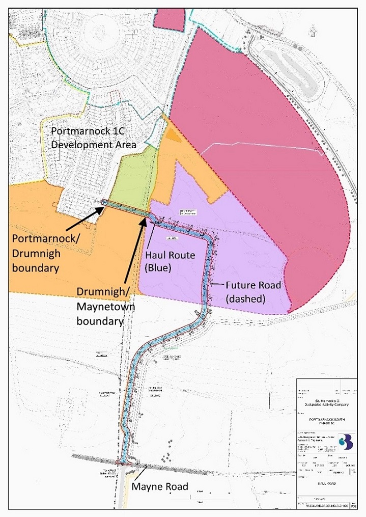
Archaeological monitoring was carried out on behalf of Saint Marnocks II DAC relating to a permitted residential development and in response to a condition of planning (ABP 305619-19). Archaeological recording of two townland boundary locations was also included in these works, relating to a proposed haul route permitted under planning reference F20A/0700.
Archaeological monitoring followed the excavation of a double ditched early medieval enclosure within the Phase 1C development area (licence ref. 19E0303) as well as two further early medieval ditched enclosure sites and a later medieval settlement in the Phase 1A and Phase 1B development areas. A phased programme of archaeological investigations and resolution also took place on the Portmarnock lands over the period from 2000 to 2008 in advance of development. As a result of the early investigations two significant recorded monuments, the Portmarnock mound DU015-014 and the Maynetown enclosure DU015-055, were scheduled to be preserved in situ.
Archaeological monitoring within the Phase 1C development area took place intermittently between October 2020 and May 2021 and included the investigation of two 10m-wide sections of the townland boundaries between Portmarnock/Drumnigh and Drumnigh/Maynetown in relation to the construction of a haul route.
The vegetation from both the ditches and banks was removed, under archaeological direction, by a 13-tonne tracked excavator fitted with a toothed bucket, followed by the removal of topsoil from the banks, after which the banks were gradually reduced using a flat bucket and the area cleaned back by hand at intervals to assess the nature of the deposits. No features or finds of interest were noted within the bank deposits of either boundary, but two pits identified under the bank of the Portmarnock/Drumnigh boundary appear to have been associated with the main phase of activity at the adjacent double ditched enclosure which has been dated to between the 7th–9th Centuries AD (19E0303). Radiocarbon dating of one of the pits underneath the bank (663–825 AD), corresponds well with the date range for the main phase of activity at the enclosure.
The presence of the pits beneath the bank suggests there was some small-scale activity at the site in advance of the construction of the outer ditch and bank, however the dating evidence indicates that these activities were broadly contemporaneous.
While no definitive evidence was uncovered during this exercise to prove that the boundary at this location formed the eastern side of the double ditched enclosure (outer ditch), it is deemed most likely that this was the case, based on the layout of the excavated enclosure and the visible kink in the upstanding boundary at this location.
No further features, finds or deposits of archaeological interest were identified as a result of the archaeological monitoring in the Phase 1C development area.

