2021:352 - KILSHANE, Dublin
County: Dublin
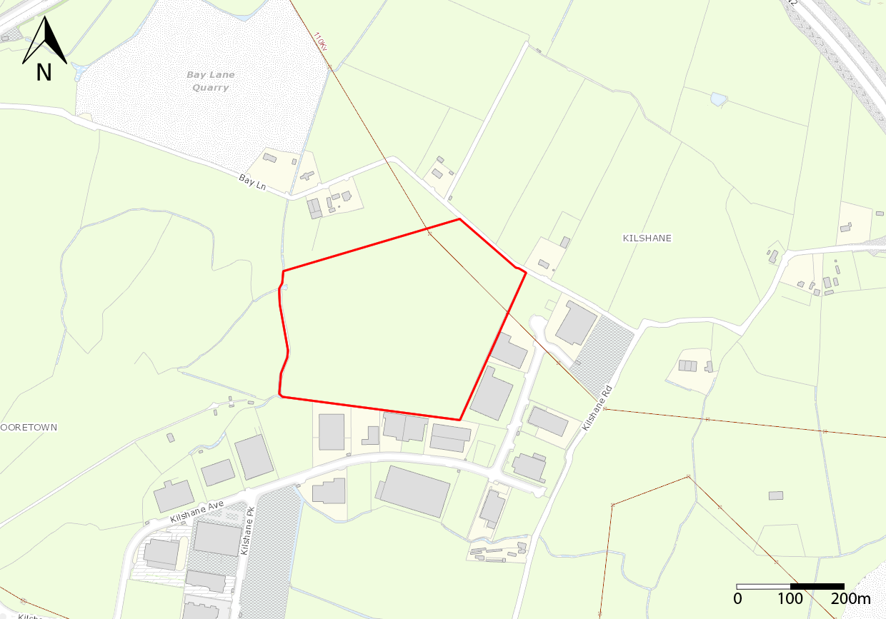
Site name: KILSHANE
Sites and Monuments Record No.: N/A
Licence number: 21E0398
Author: Níall Garahy, Courtney Deery Heritage Consultancy Ltd.
Author/Organisation Address: Courtney Deery Heritage Consultancy Ltd.
Site type: Enclosure, Burnt spread and Pit
Period/Dating: Bronze Age (2200 BC-801 BC)
ITM: E 709955m, N 742657m
Latitude, Longitude (decimal degrees): 53.422553, -6.345678
A detailed gradiometer survey was carried out (J. M. Leigh Surveys, Licence Ref. 21R0134, Leigh and Curran 2021) over the entire field, c. 12 hectares in total. The survey identified responses indicative of several enclosures in the northern half of the field.
The results of the archaeological testing largely confirmed those of the geophysical survey. Three sites of good archaeological potential identified in the north of the field corresponded to several clear responses of archaeological potential in the geophysical survey. These were a rectilinear enclosure (Site A), a D-shaped enclosure and a sub-circular enclosure (Site B) and a second, larger rectilinear enclosure (Site C).
Two additional sites of good potential were also identified during archaeological testing. Site D had been tentatively identified during the geophysical survey as an area of fired features or features containing burnt material (Leigh & Curran 2021). Testing confirmed the presence of a deeply buried ditch with a charcoal-rich fill in this area, in addition to a burnt pit. These are likely related to a former field system that was also tentatively identified in the area from the results of the geophysical survey.
Site E was identified during archaeological testing in an area of modern magnetic disturbances that interfered with the geophysical survey. It comprised several features of archaeological potential including a linear ditch, two possible curvilinear ditches, a pit and a possible post-hole.
It was recommended that all topsoil be stripped at the proposed development site as an archaeological exercise and that all features be fully excavated and recorded.