2021:267 - DUBLIN 22: Ballymakaily and Grange, Lucan, Dublin
County: Dublin
Site name: DUBLIN 22: Ballymakaily and Grange, Lucan
Sites and Monuments Record No.: N/A
Licence number: 21E0147
Author: Steve Hickey, c/o AMS
Author/Organisation Address: Fahy's Road, Kilrush, Co. Clare
Site type: No archaeology found
Period/Dating: N/A
ITM: E 702935m, N 732180m
Latitude, Longitude (decimal degrees): 53.329848, -6.454665
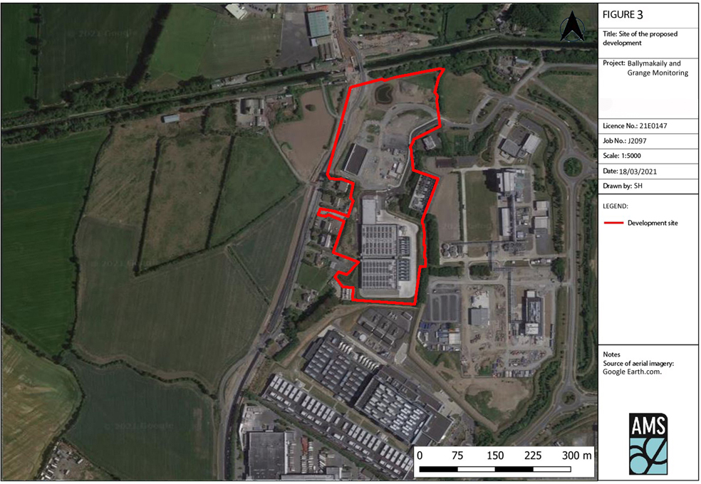
The development site measured c.77,000m2 (c.7.7 hectares). A number of archaeological investigations had been carried out on the site in 2016–17 in response to planning conditions informed by an Environmental Impact Statement (Marston Planning Consultancy 2016). The site was subject to a geophysical survey in 2016 (Licence No. 16R0070, Leigh 2016), and two phases of archaeological test-trenching (Licence No. 16E0471, O’Carroll 2016; and Licence No. 16E0471 ext., Shine 2017). Archaeological monitoring of a topsoil strip in advance of the excavation of an attenuation pond was also undertaken at this time. No features of archaeological significance were uncovered during the testing or monitoring works; however, due to the discovery of archaeological remains in the wider region, a recommendation for further monitoring of works within the northern portion of the site was made in the Test-Trenching and Monitoring Report (Shine 2017, p.13).
AMS was contacted (17 February 2021) to carry out any outstanding monitoring in advance of the latest phase of construction on-site. No finds or features of any archaeological significance were uncovered during this phase of archaeological works.
No further archaeological works were recommended for the site.