2021:224 - GLENAMUCK NORTH, Dublin
County: Dublin
Site name: GLENAMUCK NORTH
Sites and Monuments Record No.: N/A
Licence number: 21E0734
Author: Steven McGlade, Archaeology Plan
Author/Organisation Address: 32 Fitzwilliam Place, Dublin 2
Site type: Fulacht fia
Period/Dating: Prehistoric (12700 BC-AD 400)
ITM: E 720680m, N 722890m
Latitude, Longitude (decimal degrees): 53.242654, -6.191926
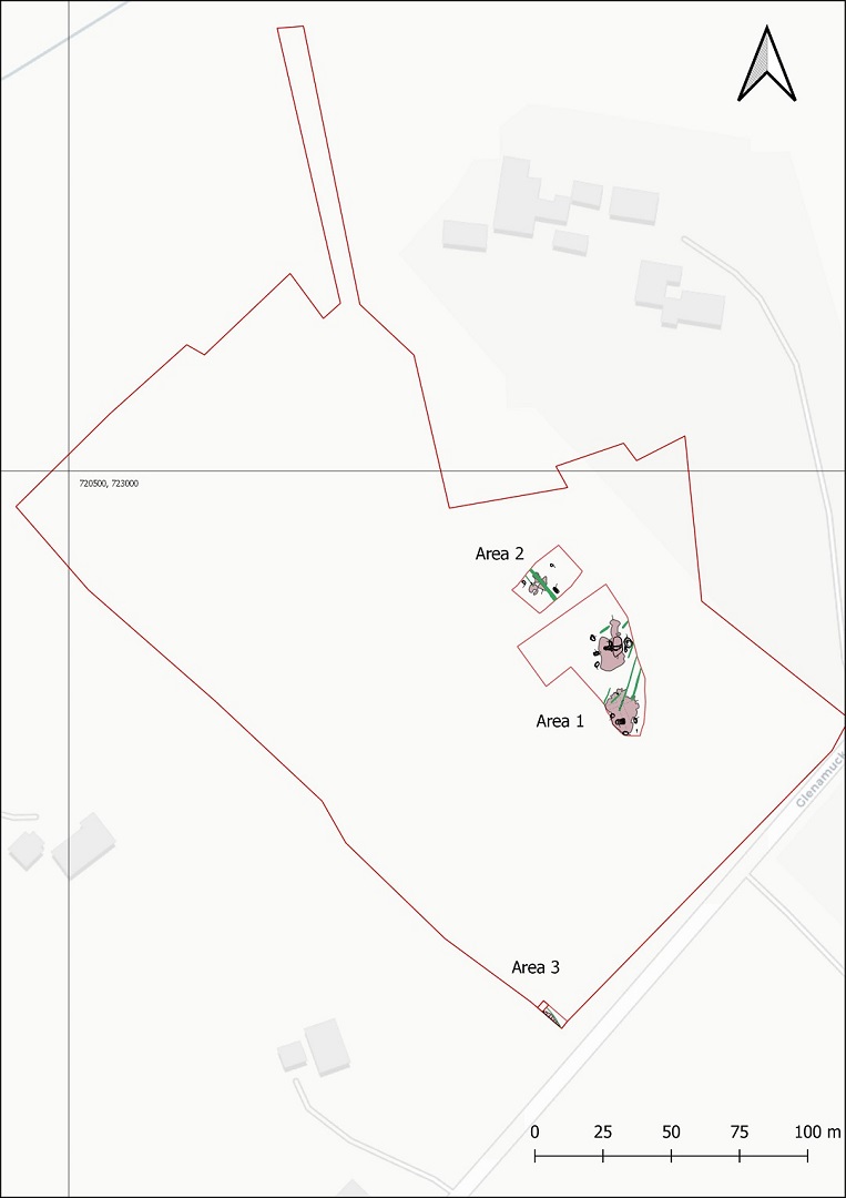
A programme of archaeological monitoring and subsequent excavation was undertaken on a site in Glenamuck North, Co. Dublin. The site was divided into two main fields with a small section of a third field also forming part of the site. The Phase 1 lands included the south-east field and a small section of the north-west field. The monitoring programme identified three archaeological areas, which were excavated under the same licence. A wetland area dominated the central portion of Phase 1, with a number of post-medieval and modern drains and ditches identified attempting to drain the area. The wetlands were the attraction for the archaeology identified on the site, with three fulachtaí fia identified along with a portion of a burnt spread that continued beyond the limit of excavation.
Area 1 was located in the south-east field and included two fulachtaí fia. Fulacht Fiadh 1 included two sub-rectangular troughs (3.12m by 1.54m by 0.42m and 1.96m by 1.3m by 0.36m) and a number of additional shallow pits along with the remains of the burnt spread. The burnt spread was thin and denuded with a number of plough furrows and drainage features crossing it. It was dominated by fragmented and burnt granite, most of which was broken down to coarse sand. Some differentiation in the spread was also noted, with the spread to the east of the main trough largely consisting of charcoal with little stone noted. This appeared to relate to waste from the fires where the stones were heated. While hearths were not identified the charcoal within the spread to the east suggests the hearth would have been located nearby. An arc of stake-holes representing a lightweight shelter, screen or rack was identified at the end of one of the troughs. This structure may have screened or protected the access to the fulacht from the east.
Fulacht Fiadh 2 was located to the south and included a large sub-rectangular trough (3.5m by 2m by 0.61m) and a number of additional pits along with the remains of the burnt spread. As with the spread for Fulacht Fiadh 1 the spread was thin and denuded. There was no indication of where the hearth or hearths may have been located, though the spread contained a higher density of burnt stone to the north. Again granite was the stone chosen for use at the fulacht. A number of sherds of prehistoric pottery, some of which were decorated, were retrieved from one of the fills of the trough and from the fill of a pit to the east. A worked piece of flint was also retrieved from the trough. The pottery and flint were in one of the upper fills of the trough and may have originally been deposited in the burnt mound. Prehistoric pottery is a rare discovery at fulacht fiadh sites and analysis of the sherds may give us an insight into the activities being carried out here.
Area 2 was located in the north-east field and contained the remains of Fulacht Fiadh 3. This consisted of a trough (2.4m by 1.3m by 0.5m) and a heavily truncated burnt spread to the north. A pit was also uncovered nearby that may have been related. This area was previously beneath a hedgerow along the field boundary and was more truncated than the other areas.
Area 3 was located along the south-west limit of excavation and contained the edge of another burnt spread. This is likely to be part of an additional fulacht fiadh located to the south-west beyond the site boundary.
Granite was the predominant stone selected for use at the fulachtaí fia uncovered during the excavation at Glenamuck North. Granite is generally not the preferred stone used at fulacht fiadh sites elsewhere, however a cluster of sites in the vicinity of Glenamuck were also recorded as using granite. This likely reflects the local geology and the availability of granite in the area, and perhaps the limited access to alternatives.
The four troughs uncovered were all sub-rectangular and unlined. All had bases sloping towards one end. There was no obvious purpose for the sloped bases of the troughs, though the feature may relate to the use of the troughs, the control of the water heating, or possibly to assist in the clearing of waste stone after a heating event.
Post-excavation processing and analyses are now underway. A programme of test-trenching is to be carried out on the Phase 2 portion of the development in the New Year.