2021:133 - DUBLIN 6W: Mount Argus, Kimmage Road Lower, Harold's Cross, Dublin
County: Dublin
Site name: DUBLIN 6W: Mount Argus, Kimmage Road Lower, Harold's Cross
Sites and Monuments Record No.: N/A
Licence number: 21E0248
Author: Thaddeus Breen & Marion Sutton; Shanarc Archaeology Ltd.
Author/Organisation Address: Unit 39a, Hebron Business Park, Hebron Road, Kilkenny
Site type: Town
Period/Dating: Modern (AD 1750-AD 2000)
ITM: E 714067m, N 731548m
Latitude, Longitude (decimal degrees): 53.321890, -6.287848
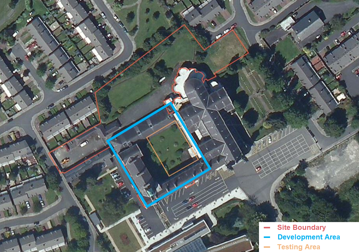
Archaeological test excavation was carried out on 14 July 2021, in compliance with a condition of the grant of planning by An Bord Pleanála Board Order ABP-308482-20 relating to the the adaptation of an existing former monastery building for residential use, and the construction of a residential block on a site adjoining a Protected Structure (Mount Argus Catholic Church), on Kimmage Road Lower, Harold’s Cross, Dublin.
The development site encompasses the former Mount Argus Monastery, known as St. Paul’s Retreat, laid out on a central courtyard, forming part of the curtilage of the adjoining Mount Argus Catholic Church, Protected Structure RPS Ref. 4260. The existing complex developed through the 19th and 20th centuries at the site of an earlier dwelling house in Argos townland, known as Mount Argos or Mount Argus. The former Mount Argus Monastery forms part of a larger landbank in the ownership of the client adjoining Mount Argus Catholic Church which is accessed from the west off Mount Argus Avenue and from the east off Church Park Avenue.
Five test trenches were excavated. Four trenches measured 10m long and 1.8m wide, running north-east/south-west. The fifth ran approximately north-west/south-east and measured 6m long and 1.8m wide, its length constrained by existing services. The general stratigraphy of excavated material comprised 0.2–1.2m of topsoil and loose built-up dark brown garden soil overlying light yellow-brown natural. Finds comprised occasional clay-pipe fragments and occasional post-medieval pottery sherds.
No archaeological features or deposits were found during testing.

