2021:109 - DUBLIN 2: ‘Site B’, Townsend Street/Shaw Street, Dublin
County: Dublin
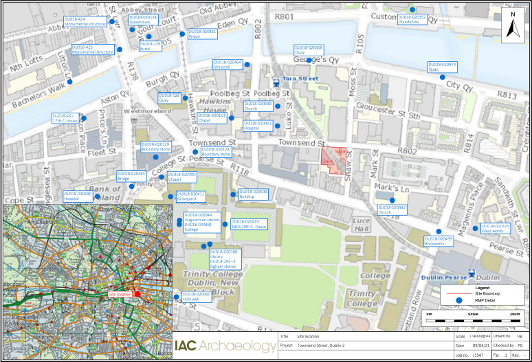
Site name: DUBLIN 2: ‘Site B’, Townsend Street/Shaw Street
Sites and Monuments Record No.: N/A
Licence number: 20E0659
Author: Paul Duffy, c/o IAC Ltd.
Author/Organisation Address: Unit G1 Network Enterprise Park, Kilcoole, Co. Wicklow
Site type: Historic town
Period/Dating: Multi-period
ITM: E 716359m, N 734239m
Latitude, Longitude (decimal degrees): 53.345564, -6.252475
Archaeological testing was carried out over 3 days spanning 3 December 2020, 25 March 2021 and 7 April 2021. A number of previous archaeological investigations have taken place within the vicinity of the development area. Previous testing on a site to the immediate south of the development site revealed nothing of archaeological significance.
Five test trenches measuring 42 linear metres were dug to investigate Site B. Brick-built masonry remains were identified in all five trenches.
Trench 1 revealed a robust red-brick wall 0.5m below ground level which extended to 1.5m below ground level and the angled wall of a corner fireplace (C1).
Trench 2 revealed a red-brick wall (C2) reaching to 2.5m below ground, an infilled cellar with the upper 2m consisting of demolition rubble including mortar, red brick, and roof slate indicating a collapsed building that was levelled over. A brick and cobble surface (C4) were identified to the south of the cellar wall 0.4m below ground level, consistent with the original yard level.
Trench 3 was placed to target the western side of the cellar identified in trench 2. The wall (C3) was discovered and was of similar construction with high-fired red brick and cream coloured mortar bonding.
Trench 4 uncovered a wall (C6) that was generally aligned with the corner fireplace (C1) identified in trench 1. An oval pit (C11) filled with mid-brown clay with inclusions of brink and pantile fragments was also identified.
Trench 5 revealed a boundary wall (C8) on the northern edge of the trench with two later walls abutted from the east. These walls (C7 & C9) formed sand and cement floors and extended beyond the limits of the trench.
The results from the testing correspond very closely with the detailed plot mapping undertaken by John Rocque in 1756. The walls C6 and C8 line up with the long boundary plots while C8 abuts the back corner of the upstanding structure at 149 Townsend Street. The east-west running walls and surfaces identified in Trench 5 represent later structures dating to the 19th century when the OS mapping shows the rear plots of the structures fronting Townsend Street were subdivided into small plots fronting the recently laid out Shaw Street.