2021:074 - FLEMINGTOWN, Balbriggan, Dublin
County: Dublin
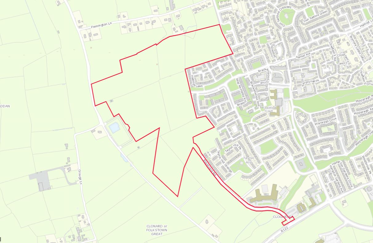
Site name: FLEMINGTOWN, Balbriggan
Sites and Monuments Record No.: DU001-023
Licence number: 21E0298
Author: Gill McLoughlin, C/O Courtney Deery Heritage Consultancy
Author/Organisation Address: Lynwood House, Ballinteer Road, Dublin 16
Site type: Field system
Period/Dating: Medieval (AD 400-AD 1600)
ITM: E 718050m, N 764000m
Latitude, Longitude (decimal degrees): 53.612514, -6.215909
Pre-planning archaeological testing was carried out in relation to a proposed SDH planning application. The site is bounded by the Clonard Road to the west and south-west and Flemingtown Lane to the north. Existing housing lies to the east, and to the south-east are the lands of a separate ongoing housing development.
The lands were formerly intended for development under the discontinued Balbriggan North West Local Area Plan and a series of investigations were undertaken between 2006 and 2008 as part of that project, revealing 18 archaeological areas within the application lands, six of which were added to the Sites and Monuments Record (DU001-022001, DU001-022002, DU001-015, DU001-023, DU001-024, DU001-025, DU001-026, DU001-027). It should be noted that at the time of writing two of these SMR sites (RMPs DU001-024 and DU001-0025) appear on www.archaeology.ie with an error in the co-ordinates, resulting in the depiction of DU001-024 in the webGIS outside of the application area to the east and DU001-025 approximately 80m east of its true location.
The main aim of the testing was to assess the extent of the features around the fringes of the concentration of features designated as field system DU001-023. The testing also aimed to confirm the location of a possible enclosure indicated in geophysical survey (possibly the mis-located DU001-024) and to test the location of a possible sub-surface enclosure visible on google maps (June 2018) which has recently been added to the record (DU001-033).
Testing took place over nine days from 31 May 2021 and confirmed the presence of substantial archaeological features in trenches T14 – T20 inclusive, which corresponded with the concentration of anomalies representing field system DU001-023 as indicated in the geophysical survey. The geophysical survey interpretation was found to have a high degree of accuracy where anomalies were interpreted as definite archaeology (purple on the interpretation drawing). Associated with, but outside of the main concentration, there were less substantial archaeological features present in trenches T10 and T11 and possible archaeology in the form of linear ditch/gully-type features present in trenches T4, T5 and T8.
There were no features of archaeological interest identified in trenches T2 and T3 in the location of the possible enclosure indicated in the geophysical survey. The presence of a possible ditched enclosure indicated in aerial photography (DU001-033) was confirmed in trench T1 as a double ditched enclosure.
No dateable finds were recovered from any of the investigated features, but the field system most likely dates to the early medieval period (based on a lack of dateable finds and dating of the previously excavated, associated site to the south). Based on form, the double ditched enclosure could date to the Bronze Age or the early medieval period.